Oilfields are essential to the world’s energy supply, and monitoring their stability is critical to ensure safe and sustainable production. One way to monitor oilfields is through Synthetic Aperture Radar (SAR) technology, which uses radar waves to detect changes in ground displacement. SAR technology can provide highly accurate and reliable data on ground movements, including subsidence and uplift, which can indicate potential risks to infrastructure and production operations. The use of SAR technology for oilfield ground displacement monitoring has become increasingly important in recent years, as the industry seeks to improve safety and reduce environmental impacts. This technology can help oil companies make informed decisions about resource extraction and mitigate potential risks associated with ground displacement. In this article, we will explore the benefits and challenges of using SAR for oilfield ground displacement monitoring and its applications in the oil and gas industry.
The Problem
The existence and geomorphological condition of Terrain deformation is a major concern for Oil and Gas industries. Fluid injection is one of the inevitable processes to increase the efficiency of extraction, significant uplifts can occur. Deep-level extraction of Oil and gas will affect unexpected land subsidence, high spatial variations, improper structural stability of the well, and positioning of boreholes at risk.
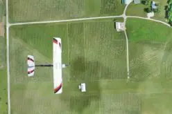
Normally geoscientists wanted to locate the spatial occurrence/visibility of oil and gas with imagery using GPS.
Solution
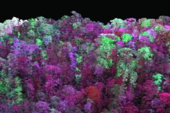
Synthetic Aperture Radar (SAR) and Multi-temporal interferometric stacking techniques are used to monitor ground deformation phenomena, land subsidence, and surface creep. There are two kinds of techniques a) The Persistent Scatters (PS) method is extensively used to monitor the displacement or shifting of localized structures typically man-made structures like high-rise buildings, dams, and bridges. B) The advanced Small baseline subsets (SBAS) interferometric technique will analyze of series of radar images to gather outlines of the spatial and temporal evolution of terrain movements. In the case of SAR data, they have their own energy which is able to collect the data during the day, night, and even in the cloud period also.
Monitoring Displacement of Oilfields with SAR
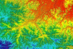
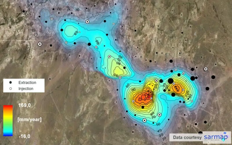
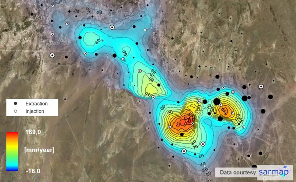
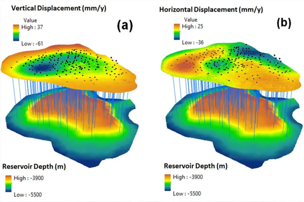
Considering the case study of the Tengiz oilfield is located on the coast of the Caspian Sea and covers an area of approximately 2,500 km², extending 19 km in length and 21 km in width, with up to 1.5 km in thickness. There are two kinds of displacements like Vertical and Horizontal measured on the surface with help of SAR data Cosmo-SkyMed, TerraSAR-X, and medium-resolution Sentinel-1 using SAR Interferometric Stacking techniques.
The maximum average vertical subsidence in the Tengiz oilfield was measured at −57 mm/year. Fifteen wells and three facilities were observed to be located within a measured subsidence range between −55.6 to −42 mm/year. The proximity of subsidence hotspots is subjected to a natural tectonic process with two faults, the flow of water streams towards land subsidence.
Conclusion
Space-oriented SAR data is highly useful and unique across many industries with a variety of applications in hazard monitoring, Oil spillages, change detection, and land subsidence.
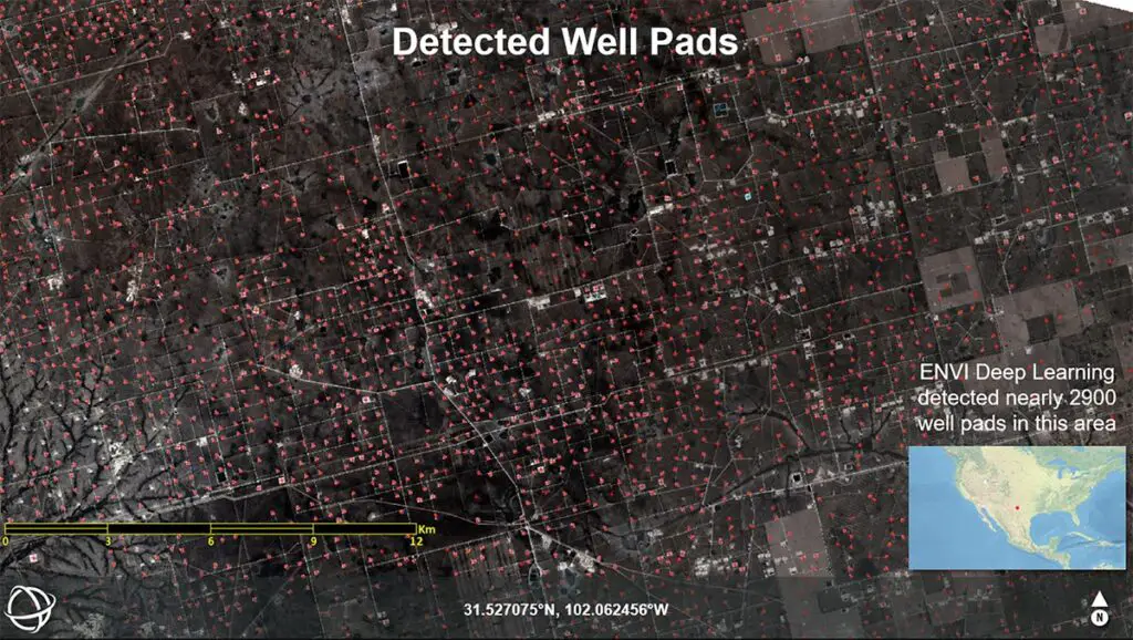
ENVISAR scape which is advanced processing software provides automation in measuring the spatial distribution of shifting of oil and gas anomalies and reduces the risk and cost in exploration activity.
Source: L3Harris
Also Read –
Free and Open Source SAR Image Processing Software