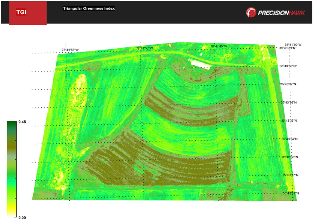
DataMapper has recently introduced Triangular Greenness Index app in the DataMapper’s Algorithm Marketplace. Triangular Greenness Index is developed by Exogenesis, an advanced GIS and remote sensing company, the app is a highly specialized and optimized vegetation index.
Triangular Greenness Index app is a simple triangular greenness index for sensing leaf chlorophyll content based on true color imagery. The index was the result of a study to create an index that is sensitive to differences in leaf chlorophyll content at leaf and canopy scales, when limited to true color.
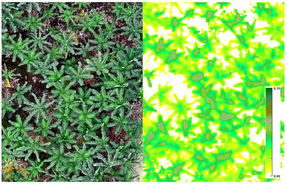
Credit: DataMapper
With DataMapper, users process collected drone imagery into 2D/3D representations of their fields. Then, they can simply click to apply the Triangular Greenness Index app for automated analysis of the map.
About Triangular Greenness Index:
- Supported Sensors: RGB
- Supported Resolution: 20.00 cm/px or less
- Estimated Processing: Less than 2 hours
Inputs Required
- Orthorectified Image (GeoTIFF)
- Region of Interest (Shapefile)
Outputs/Deliverables
- Georeferenced Index Image (Compressed Folder containing GeoTIFF)
- KML and TMS Tile Set (Compressed Folder)
- PDF report depicting 2D map of results
Credit: DataMapper
Traditionally, vegetation index readings are used to capture photosynthetic activity and assess plant health, such as nitrogen deficiencies. However, later in the season, they often do not produce accurate results due to saturation as the canopy closes. The Triangular Greenness Index app accounts for this and is additionally not sensitive to pixel resolution, allowing growers to fly later in the growing season by limiting issues with photo stitching and data quality.
About Exogenesis
Exogenesis is a provider of advanced analytics, algorithm development, and predictive modeling and simulation for geospatial data. Now partnered with DataMapper, the Exogenesis team is committed to solutions that provides clients with useful insights across industries.