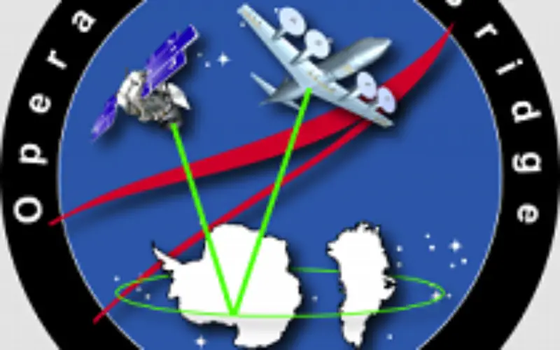
 NASA’s Operation IceBridge, an airborne mission started in 2009 to monitor Antarctic and Arctic ice.
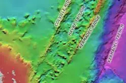
IceBridge is the largest airborne survey of Earth’s polar ice ever flown and will use airborne instruments to map Arctic and Antarctic areas once a year. An aircraft flies over the ice, and three-dimensional view of Arctic and Antarctic ice sheets, ice shelves and sea ice data collected by radar and other onboard equipment.
These temporal data sets by flights will provide a look at the behavior of the rapidly changing features of the Greenland and Antarctic ice of the period of time. The data products resulting from the measurements are used by modelers and scientists to determine changes in the mass of the ice sheet.

Data collected during IceBridge will help scientists bridge the gap in polar observations between NASA’s Ice, Cloud and Land Elevation Satellite (ICESat) — in orbit since 2003 — and ICESat-2, planned for late 2015. ICESat stopped collecting science data in 2009, making IceBridge critical for ensuring a continuous series of observations.
The first IceBridge flights were conducted in March/May 2009 over Greenland and in October/November 2009 over Antarctica.