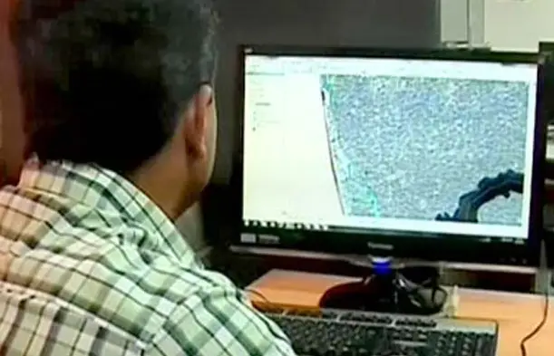
An official carrying out mapping to demarcate inhabited areas in proposed ESAs. Image Courtesy: Manoramaonline
Kollam: The process of demarcating inhabited areas in the 123 villages, which are Ecologically Sensitive Areas (ESAs) as per the Kasturirangan draft report, is halfway through.
The State Remote Sensing and Environment Centre is demarcating houses and farm lands using the Geographic Information System (GIS).
Scientists and technical experts of the State Remote Sensing and Environment Centre are demarcating houses, other buildings, farm lands and plantations in 123 villages in 12 districts which have been included in the ESAs as per the Kasturirangan report. The Union Ministry of Environment & Forests can announce the final notification only after the maps are completed.
The mapping of eight villages in a taluk in Kollam has been completed and it is available at www.ksrec.kerala.gov.in
The public can express their opinion after going through the mapping.
The mapping of another 15 villages is in the final stage.
Read Original Story from MANORAMAONLINE.COM