Pakistan to Adopt Remote Sensing and GIS Based Flood Mitigation System
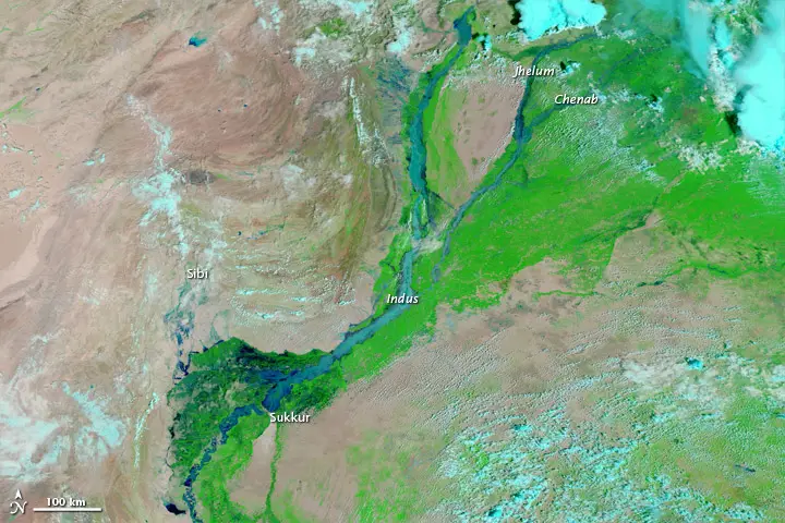
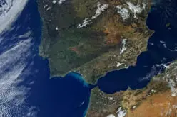
Flooding in Pakistan August 13, 2010. Image Courtesy: NASA
In recent news by The Express Tribune, Pakistan Space and Upper Atmosphere Research Commission (SUPARCO) in collaboration with UNESCO will install satellite remote sensing and GIS technologies across Pakistan for flood mitigation.
This was revealed in a two day seminar on “Safe, Connected Communities against Floods through Remote Sensing and GIS tools”.
The system aims to strengthen the role of earth observation satellites in flood mapping, flood damage estimation, strategically planning for the in rehabilitation and life safeguarding. The system also aims to develop web-based GIS visualisation tools for information dissemination.
UNESCO Country Director Dr Kozue Kay Nagata said:
“The web-based platform is now functional and we hope to have established a system of near real-time repository of flood management data.”
Federal Minister for Planning and Development Ahsan Iqbal said:
“Water scarcity will become a greater issue than energy crisis in a few years.”
Japanese Ambassador Hiroshi Inomata said,
“Having suffered from many disasters in the past, Japan has continued to develop indigenous technologies and expertise for disaster risk management and mitigation.”
UNESCO Regional Science Bureau for Asia and the Pacific Deputy Director Dr Shahbaz Khan said:
“If no steps are taken, Pakistan will soon be compared to Afghanistan.”
Source: The Express Tribune