In the picturesque landscapes of Europe, a silent revolution is taking place in the fields of countless farms. At the heart of this transformation is the Soil Quality Analysis Tool project, an EU-funded initiative aimed at tackling soil quality and sustainability issues in the agricultural industry. This innovative project is set to change the way farmers understand and manage their soil, bringing forth a new era of precision farming.
For decades, precision agriculture has been on the rise, offering farmers more efficient ways to manage their crops. Yet, despite these advancements, the fundamental method of collecting soil information has remained largely unchanged. The need for better data on soil properties has become increasingly apparent. Enter the Soil Quality Analysis Tool (SQAT) project, which promises to deliver just that through a groundbreaking mapping service.
The SQAT project is a beacon of hope for farmers seeking to improve soil health while reducing costs. By integrating Earth observation data, soil sensors, and robotics, SQAT is creating a cost-effective technique to precisely map soil properties. This comprehensive approach ensures that farmers have access to detailed and accurate soil data, empowering them to make informed decisions that enhance resource efficiency and sustainability.
Similar Read: How GIS and Geospatial Tech Can Enhance the Agriculture Sector
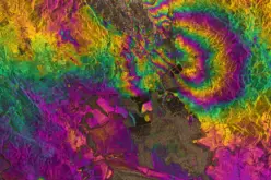
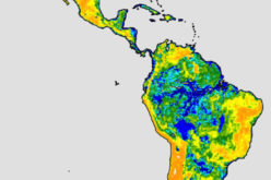
One of the most remarkable aspects of SQAT is its use of satellite imagery from the Copernicus program. This satellite data helps identify potential soil property zones, creating a detailed map of the soil’s characteristics. To gather this data, the project employs a toolbox of various sensors, which are meticulously calibrated using soil samples. This ensures that the maps produced are not only accurate but also highly reliable.
To streamline the process further, the sensors are mounted on autonomous robots, enabling rapid and extensive field mapping. This innovation allows farmers to cover larger areas more quickly than traditional methods, significantly optimizing the soil sampling process. Moreover, the flexibility of the solution means it can be adapted to different conditions and utilized with various field robots, quads, or vehicles, provided they can bear the weight of the sensors.
“Farmers stand to benefit in several ways, depending on how the data will be used,” says Igor Milosavljevic, manager of European affairs at the Association of Balkan Eco-Innovation. The soil properties maps provided by SQAT offer a highly accurate and affordable solution, previously unattainable for many farmers. With this valuable data, farmers can optimize their farm operations, improve planting patterns, and ultimately reduce input costs while increasing revenue.
Additionally, service providers can harness this robust spatial soil data to develop new precision agriculture applications. This unlocks new horizons for agricultural innovation, delivering further value to farmers. The SQAT project is developing five such services: variable rate liming, variable rate seeding, variable rate macronutrient fertilization, variable depth tillage, and a carbon farming monitoring, reporting, and verification solution. These services collectively aim to reduce expenses for fuel, lime, fertilizer, and seeds while maintaining or boosting crop yields.
Benefits of SQAT
SQAT’s innovative approach offers several significant benefits:
- Precise and cost-effective soil maps: Farmers gain access to detailed and accurate soil data without the high costs associated with traditional methods.
- Near real-time mapping results: Rapid data processing ensures timely insights for effective decision-making.
- Reduced need for lab samples: Minimizes reliance on expensive and time-consuming laboratory analyses.
- Five smart farming applications: Enhancing various aspects of farm management:
- Variable rate liming: Calculates precise liming needs for different field zones.
- Variable rate macronutrient fertilization: Automates soil properties testing for macronutrients.
- Variable rate seeding: Tailors seeding density to soil properties, optimizing costs and yields.
- Variable depth tillage: Prevents soil compaction and improves fuel efficiency by targeting subsoiling efforts.
- Carbon farming MRV solution: Provides accurate estimation of soil carbon, supporting effective carbon monitoring, reporting, and verification.

As the SQAT project continues to advance, it holds the promise of a brighter future for sustainable agriculture. By focusing on Soil Quality Analysis and leveraging cutting-edge technology, SQAT is not just enhancing the efficiency of farming practices but also ensuring the long-term health and productivity of the soil. This groundbreaking project is a testament to the power of innovation in transforming the agricultural landscape, paving the way for a more sustainable and prosperous future for farmers and the environment alike.
Source: CORDIS -EU