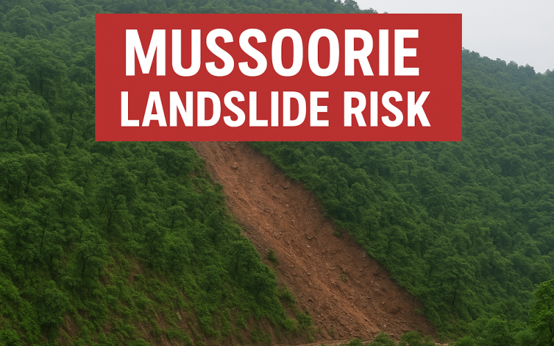
In a stark warning issued by the Wadia Institute of Himalayan Geology (WIHG), the popular hill station Mussoorie is facing serious terrain instability — the study reveals that around fifteen percent of the area falls in a high-risk landslide zone.
The research team surveyed an 84 sq km area and used advanced GIS mapping and satellite imagery to pinpoint zones of vulnerability. Lead researcher Anil Joshi highlighted that steep slopes — many exceeding 60 degrees — and fractured Krol limestone formations are major contributing factors to the danger.
Why the danger is escalating
The study emphasises how “unsustainable construction and slope-cutting” have dramatically increased the risk of landslides. Some of the most vulnerable hotspots include Bhattaghat, George Everest, Kempty Fall, Khatta Pani, Library Road, Galogidhar and Hathipaon. Using statistical methods including the Yule Coefficient and high-resolution satellite imagery, the WIHG team mapped susceptibility into three categories: high risk (15 %), moderate risk (29 %), and low to very low susceptibility (56 %).
“Mussoorie landslide risk” is amplified by slope degradation and anthropogenic interference, meaning the picturesque “Queen of Hills” may no longer be safe without intervention.
What’s at stake and the path ahead
This warning flags a broader concern across the Himalayan belt: towns such as Nainital, Champawat, Pithoragarh and Joshimath are facing similar stress on slopes from development pressures. The study insists on urgent measures: halting uncontrolled construction, banning indiscriminate road-cutting, strengthening drainage and making geological studies mandatory for all future urban planning.
As environmental writer Jai Singh Rawat stated, the research delivers a vital message: “development in fragile ecosystems like the Himalayas cannot proceed without respecting nature’s boundaries.” For Mussoorie, embracing this reality could mean the difference between a thriving hill station and one beset by collapse.
The “Mussoorie landslide risk” captures more than a geological classification — it signals a warning for policymakers, developers and residents alike. Without decisive action now, the beloved hill town may face serious consequences in the near future.
Source: The New Indian Express