Supervised Classification of Agricultural Land Cover Using a Modified k-NN Technique (MNN) and Landsat Remote Sensing Imagery

Supervised Classification of Agricultural Land Cover Using a Modified k-NN Technique (MNN) and Landsat Remote Sensing Imagery
Luis Samaniego and Karsten Schulz
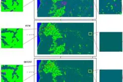
 Abstract: Nearest neighbor techniques are commonly used in remote sensing, pattern recognition and statistics to classify objects into a predefined number of categories based on a given set of predictors. These techniques are especially useful for highly nonlinear relationship between the variables. In most studies the distance measure is adopted a priori. In contrast we propose a general procedure to find an adaptive metric that combines a local variance reducing technique and a linear embedding of the observation space into an appropriate Euclidean space. To illustrate the application of this technique, two agricultural land cover classifications using mono-temporal and multi-temporal Landsat scenes are presented. The results of the study, compared with standard approaches used in remote sensing such as maximum likelihood (ML) or k-Nearest Neighbor (k-NN) indicate substantial improvement with regard to the overall accuracy and the cardinality of the calibration data set.
Also, using MNN in a soft/fuzzy classification framework demonstrated to be a very useful tool in order to derive critical areas that need some further attention and investment concerning additional calibration data.
Keywords: land use classification; supervised classification; nearest neighbors; agricultural land cover; crops


