
Tag "3D Modelling"

Strong Increase Enquiries on UAVs for Mapping and 3D Modelling in 2015
Geo-matching.com is the first independent product comparison website for geomatic, hydrographic and related industries field. Especially the enquiries and traffic on UAS for Mapping and 3D Modelling products have shown
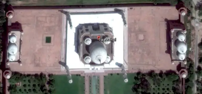
India May Soon Have 3D Imagery of Major Cities
3D imagery of buildings and terrain of India’s major cities, including Rashtrapati Bhavan and PMO, could soon be seen in Google Earth with the government contemplating to give permission for

Geo-matching.com Updates Total Stations Category
Geo-matching.com has recently updated the specifications of the Total Stations product category. Topcon and Trimble are the first suppliers that have updated the specifications for some of their total stations.
Geo-matching.com Adds Handheld Scanners Category
&bvsp; Lemmer, 30June 2015–Geo-matching.com has recently added Handheld Scanners to its broad spectrum of product categories.FARO Europe, DotProduct and Artec 3D Scannersare the first suppliers in this category.In addition to

md4-1000 from Microdrones Reviewed By the Geo-matching Community
The Geo-matching.com website features a selection of the most important geomatics equipment, including UAS for Mapping and 3D Modelling. At www.geo-matching.com, you can compare product specifications and read users’ reviews
Aibot X6 from Aibotix Reviewed by the Geo-matching Community
The Geo-matching.com website features a selection of the most important geomatics equipment, including UAS for Mapping and 3D Modelling. At www.geo-matching.com, you can compare product specifications and read users’ reviews
The 5 Most Viewed UAVs for Mapping and 3D Modelling on Geo-matching.com
The Geo-matching.com website features a selection of the most important geomatics equipment, including UAS for Mapping and 3D Modelling. At www.geo-matching.com you can compare product specifications and read users’ reviews
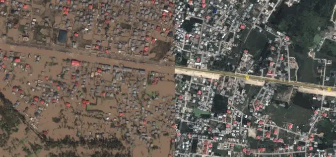
J&K Moves for Geospatial Modeling of Rivers for Flood Preparedness
J&K was severely affected by flood in September 2014, learning the lesson from past the J&K Government is planning to prepare 3D maps of terrain using geospatial techniques. Digital Elevation
Geo-matching.com Adds Big Data Management Systems Category
Lemmer, 19May 2015– Geo-matching.com has recently added Big Data Management Systems to its broad spectrum of product categories. MEIXNER IMAGING is the first supplier in this category. In addition to general specifications,detailed information
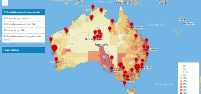
Prestigious award for Australian Solar Mapping Tools
The Australian PV Institute (APVI) has been awarded the national ENERGY GLOBE Australia Award for its suite of live generated solar photovoltaic (PV) maps and tools. ARENA CEO Ivor Frischknecht
