
Tag "3D"

SimActive Announce the Release of Correlator3D™ version 7.0
SimActive Inc., is pleased to announce the release of Correlator3D™ version 7.0, with complete redesign of its 3D generation engine enabling substantial quality and speed improvements. Version 7.0 also includes

OGC Has Approved the New 3D Portrayal Service Standard
October 4, 2017 – The membership of the Open Geospatial Consortium (OGC®) has approved the 3D Portrayal Service (3DPS) 1.0 standard. Viewing 3D geospatial content from diverse sources has just become
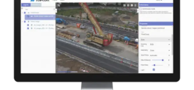
Topcon Announces New Web-Based Service for Mass Data Processing Software
LIVERMORE, Calif., U.S./ CAPELLE A/D IJSSEL, the Netherlands – September 26, 2017 – Topcon Positioning Group announces a new web-based service for integration with the MAGNET® Collage desktop mass data processing
OGC Approves Community Standard for Streaming 3D Content
September 06, 2017 – The Open Geospatial Consortium (OGC®) membership has approved a new 3D standard for content strategy. This standard is focused on high performance visualization and spatial analysis
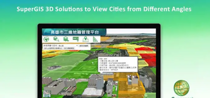
SuperGIS 3D Solutions to View Cities from Different Angles
In recent years, with the progress of information technology and hardware, many organizations are seeking to use advanced 3D tech to display their spatial data. Conforming to this trend, Supergeo,
Terra Drone Dedicated Image Processing Software Terra Mapper Begins Sales of Its Cloud Version and Desktop Version at the Same Time
Terra Drone dedicated image processing software “Terra Mapper” begins sales!! ~Cloud version and desktop version release at the same time~ Terra Drone Co., Ltd. (Head Office: Shibuya-ku, Tokyo, CEO: Tokushige

Velodyne LiDAR Appoints Robert Brown as Chief Financial Officer
August 08, 2017 – SAN JOSE, Calif.–(BUSINESS WIRE)–Velodyne LiDAR Inc., the world leader in 3D real-time perception systems for autonomous vehicles, today announced Robert (Bob) Brown has joined the company as

SuperGeo Webinar: 3D GIS Cadastral Mapping
SuperGeo Webinar: 3D GIS Cadastral Mapping Wednesday, August 16, 2017 | 10:00 AM (GMT+2) Your local time In the past, landscapes in the real world must be transformed into 2D and then

Pix4D Expands R&D in Berlin
Drone-mapping software developer Pix4D announces the opening of a research and development office in Berlin, Germany. Pix4D products rely on advanced principles of photogrammetry, computer vision, and machine learning. “By
Global Mapper 18.2 Released with New 3D Digitizing Functionality and Support for Connecting to Amazon Web Services
Hallowell, Maine – May 30, 2017 – Blue Marble Geographics (www.bluemarblegeo.com) is pleased to announce the immediate availability of Global Mapper version 18.2. This latest upgrade to the version 18
