
Tag "3D"
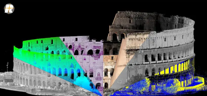
Major Update of RIEGL’s Terrestrial Laser Scanning Software Suite Now Available!
RIEGL is pleased to announce the release of a major update to their Terrestrial Laser Scanning Software Suite of RiSCAN PRO, RiMINING and RiSOLVE! The latest terrestrial laser scanning software
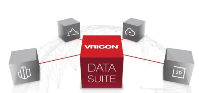
Vricon Data Suite: Putting Earth in Customers’ Hands
7 January 2016 — Today, Vricon unveils its Data Suite that includes the Vricon 3D Surface Model, Vricon DSM, Vricon Point Cloud, and Vricon True Ortho. All four products are
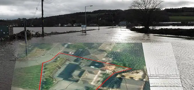
Bluesky’s 3D Aerial Maps Inform Flood Risk Assessments for Planning Applications
Aerial photography and detailed 3D height models are being used to assess the risk of flooding, and help development projects progress through the planning process. Working with Betts Hydro, part

HERE to Explore Use of Big Data
The consortium of carmakers consisting of Audi, BMW and Daimler that owns digital map maker HERE said on Monday it would explore the use of big data to improve the

US Environmental Protection Agency Chooses SimActive’s Correlator3D
SimActive Inc., a world-leading developer of photogrammetry software, has been selected by the United States Environmental Protection Agency (USEPA). They are using Correlator3D™ to create 3D datasets of vegetation for
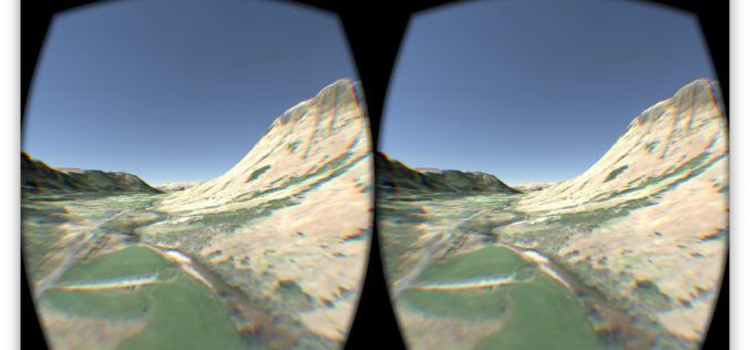
OS Data Gives Reality to a Virtual World
OS follows up its Minecraft map success to make a virtual Ben Nevis for Oculus and cardboard. The spectacular setting of Ben Nevis provides the backdrop for an Oculus Rift
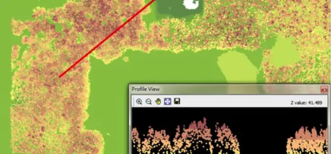
LiDAR, Point Cloud and SuperGIS Desktop 10
Have you ever thought of using LiDAR data through geographic information system to improve field tasks such as Forestry Management, Disaster Prevention, Coastal Change Management, and Contamination Simulation and so
SuperGIS Desktop 3.3 Updated with 3D Analyst and Better Maptile Productivity
SuperGIS Desktop 3.3 is now released for GIS users around the world. With the latest SuperGIS Desktop 3.3, Cache Generator is dramatically improved, supporting multiple machine workflows and providing a consummate

Photogrammetry Workshop by Ball State University
Department of Landscape Architecture, College of Architecture and Planning Ball State University is providing open and free workshop on photogrammetry. Ball State University, commonly referred to as Ball State or BSU,
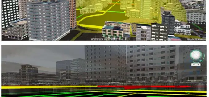
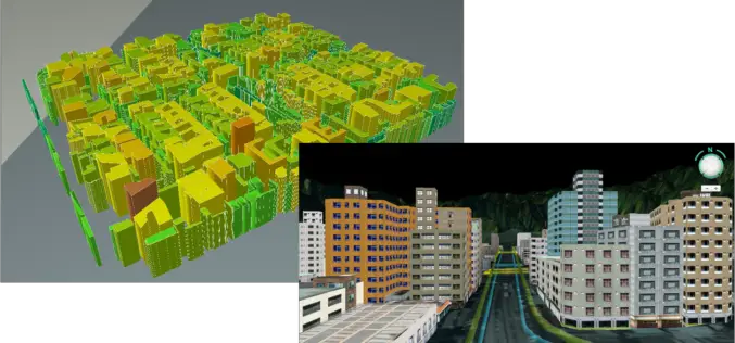
Improve Underground Utilities Management and Public Safety by 3D GIS
Developed by Supergeo Technologies, SuperGIS 3D Earth Server is going to support underground utilities management. The breakthrough tech enables administrators to comprehend the distribution of underground utilities that cannot be
