
Tag "CAD"
Trimble Business Center (TBC) v5.3 is Now Available, So What’s New in TBC v5.30?
Trimble has announced the release of version 5.30 of Trimble Business Center (TBC v5.3) office software that enables surveyors and geospatial professionals to simplify the creation of cadastral, GIS, infrastructure inspection and tunnelling deliverables.
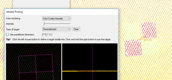
Virtual Surveyor Streamlines Workflow, Enhances User Experience with New Version of Drone Surveying Software
LEUVEN, Belgium, 10 July 2018 – The Virtual Surveyor drone surveying software now offers a faster, more efficient workflow and better overall user experience in a more stable platform. These
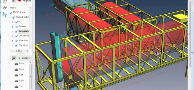
PDF3D Version 2.16 Focuses on CAD, CAE, Panoramic 360 and Engineering
PDF3D have released their latest update, Version 2.16, and deliver a powerful list of features for CAD users, CAE engineers, panoramic 360 photographers and 3D designers. June 25, 2018 –

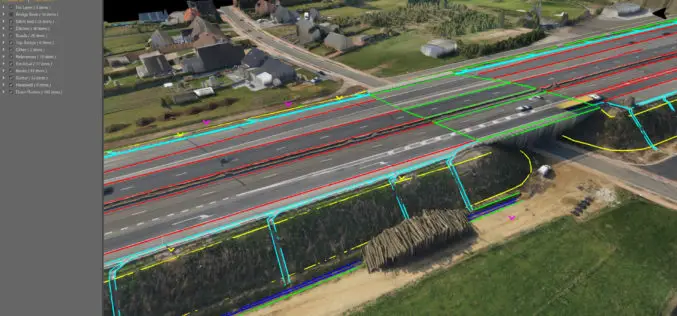
Trimble Business Center Software Adds New Vertical Solutions Support and Streamlines Field-to-Office Productivity
Enhancements for CAD, GIS, Infrastructure and Tunneling Applications SUNNYVALE, Calif., May 9, 2018—Trimble (NASDAQ: TRMB) announced today version 4.1 of Trimble® Business Center office software that enables surveyors and geospatial
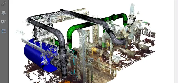
PDF3D’s V2.15 Brings New Tech, Panoramic 360 and Patented Point Cloud Simplification along with Highest Performing 3D PDF Conversion SDK
Popular 3D PDF conversion application brings a host of new features for CAD, scanning and photography, while putting DevOps first in the latest 3D PDF Development Toolkit PDF3D’s ReportGen V2.15
New Utility Post Processing Software Delivers CAD Drawings in Less Time with Professional Results
Leica DX Office Vision enables non-experienced CAD users to digitally map detected underground utilities (Heerbrugg, Switzerland, 14 June 2017) – Leica Geosystems, industry leader in measurement technology, released today its
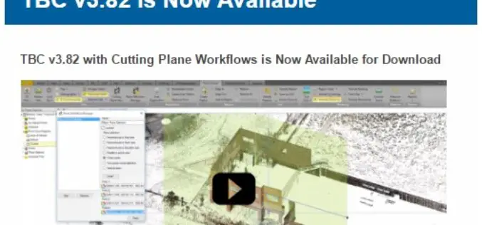
TBC v3.82 is Now Available
TBC v3.82 with Cutting Plane Workflows is Now Available for Download Trimble Business Center (TBC) is a geospatial office software that enables users to complete field-to-finish workflows efficiently and with

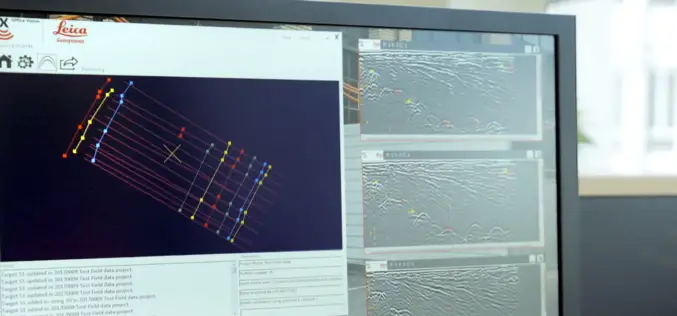
Leica Geosystems Partners with Geolantis to Integrate a Cloud Based Utility Mapping Platform
(Heerbrugg, Switzerland; Klagenfurt, Austria, 8 February 2017) – Leica Geosystems, global leader of measurement and digital reality capture technologies, has teamed with Geolantis, a provider and developer of the best-in-class
PDF3D V2.13 Release Targets Engineering and Manufacturing Workflows in 3D
3D PDF conversion software leaders, PDF3D, today announce V2.13, a major update for their entire suite of products including PDF3D SDK, XML Server, ReportGen and PV+. ReportGen users can expect
Extend Microstation CAD Designs to Mobile Users with TerraGo Edge
Live Webinar: CAD Data In the Palm of Your Hand: Extend Bentley Microstation CAD Designs to Mobile Users with TerraGo Edge August 4, 2015, 12:00PM – 12:30PM (ET) More and more CAD users
