
Tag "Digital Elevation Model"
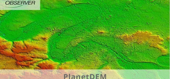
PlanetDEM – A Highly Reliable Digital Elevation Model
PlanetObserver has released PlanetDEM, its new global Digital Elevation Model (DEM) with a 30m and a 90m resolution. This new DEM offers an updated, reliable, and homogeneous 3D dataset of
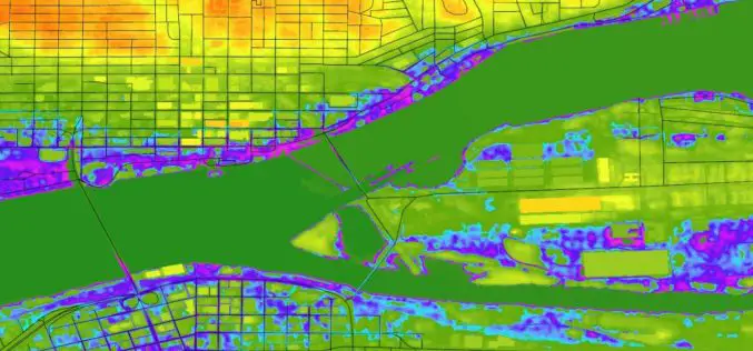
Highlight the Risk in Real Estate with Digital Elevation Model Data | cloudeo
Contributed by: Gokulakrishnan Balaji Student Marketing Munich +49 89 4141 786 23 gbalaji@cloudeo.group Location of new real estate comes with inherent uncertainties: what environmental hazards could affect this site? Before
ISRO Develops “Solar Calculator” Android App
Computation of solar energy potential is essential to select the locations for solar photovoltaic (PV) thermal power plants. The use of remote sensing observations from geostationary satellite sensors is ideal to capture
NAU Scientist Uses Remote Sensing to Detect Groundwater in Drought-stricken East Africa
Drought is a condition when a region notes a deficiency in its water supply whether surface or underground water. A drought can last for months or years, or may be declared

PCI Geomatics Announces Collaboration with Deimos Imaging to Support the PanGeo Alliance
MARKHAM, Ontario, Canada—January 10, 2017: PCI Geomatics, a world-leading developer of remote sensing and photogrammetric software and systems, announced today it will be collaborating closely with Deimos Imaging to support
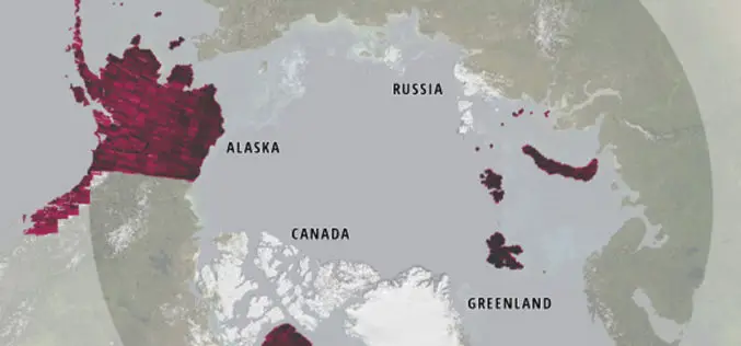
Esri Releases New Arctic Elevation Data
ArcticDEM Provides New Insight into Effects of Climate Change and Enables Communities to Take Early Action Redlands, California—Global smart-mapping leader Esri and the ArcticDEM project, a public-private initiative to produce

PCI Geomatics Webinar: Digital Elevation Models and Operational Mining Applications
Digital Elevation Models and Operational Mining Applications Case Study with NPA Satellite Mapping JUNE 29, 2016 | 10AM ET / 2PM GMT PCI Geomatics and CGG’s NPA Satellite Mapping team will
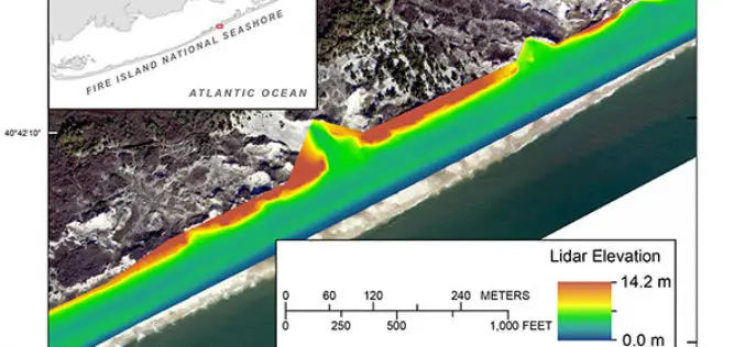
Terrestrial-based Lidar Beach Topography of Fire Island, New York
Abstract: The U.S. Geological Survey (USGS) St. Petersburg Coastal and Marine Science Center (SPCMSC) in Florida and the USGS Lower Mississippi-Gulf Water Science Center (LMG WSC) in Montgomery, Alabama, collaborated to
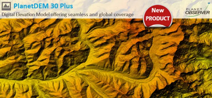
PlanetDEM 30 Plus: The New Global Digital Elevation Model at 30-Meter Resolution Offering Seamless, Reliable and Accurate Data
PlanetObserver, specialist of geospatial data production for more than 25 years, announced today the release of PlanetDEM 30 Plus global elevation model. PlanetDEM 30 Plus is the new Digital Elevation

Make Better Geospatial Decisions with Accurate Elevation Data
ENVI Webinar: Make Better Geospatial Decisions with Accurate Elevation Data November 5, 2015; 3:30 PM Berlin (GMT +2); 1PM New York (GMT -4) Precise elevation data is the initial foundation of any accurate geospatial
