
Tag "Georeferencing"

Trimble Introduces New Direct Georeferencing Portfolio for UAV Mapping
Trimble (Nasdaq: TRMB) has announced the launch of premium direct georeferencing solutions for mapping sensors on uncrewed aerial vehicles (UAVs) – the Trimble® APX RTX portfolio. When used by original

SimActive Automates Direct Georeferencing
October 31, 2017 – SimActive is pleased to announce an automated solution for direct georeferencing from real-time kinematic (RTK) positioning. Within the new workflow feature, users can easily get high accuracy

Trimble GNSS Smart Target Base Station Provides Simplified Map Production from UAVs
High-Performance GNSS Reference Station and Ground Control in One Easy-to-Deploy Package BERLIN, Sept. 26, 2017—Trimble (NASDAQ: TRMB) announced today the release of the Trimble® GNSS Smart Target Base Station for

Supergeo Confirms Dealership with National Space Organization for FORMOSAT-2 Satellite Imagery
Supergeo Technologies, the leading GIS software and solution provider, announces an agreement with National Space Organization (NSPO), Taiwan to resell the satellite imagery of FORMOSAT-2. The 891 km-above-ground FORMOSAT-2 is
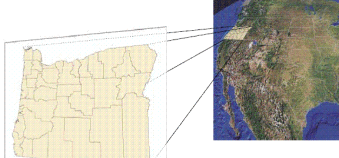
A Case Study: Using Drones in Place of LiDAR
Energizer Resources Inc., has started a major flagship project, a large graphite mining project at coast of East Africa, in Madagascar. it is named the Molo Graphite Project, or simply
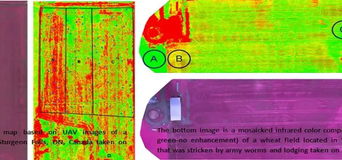
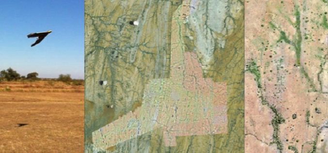
Applications of Low Altitude Remote Sensing in Agriculture
In a study by Chunhua Zhang et. al., on “Applications of Low Altitude Remote Sensing in Agriculture upon Farmers’ Requests– A Case Study in Northeastern Ontario, Canada” reveals the importance
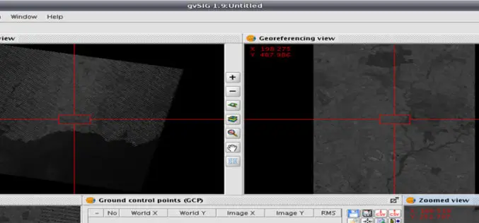
Issues to be Addressed While Georeferencing
I already have discussed about Georeferencing in my previous post on August 28, 2013. Today I am adding few more important issues that need to be considered while understanding Geo-referencing
What is Georeferencing?
Today I was wondering while thinking about what I should post on GIS Resources. Then suddenly I got a click, why not about What is Georeferencing or what is georeferencing
