
Tag "geospatial"
DigitalGlobe Adds New, Innovative Partners to Its Rapidly Growing Geospatial Big Data Ecosystem
WESTMINSTER, Colo.–(BUSINESS WIRE)–Feb. 7, 2017– DigitalGlobe, Inc. (NYSE: DGI), the global leader in Earth imagery and information about our changing planet, announced the growth of its ecosystem of content producers

How Geospatial Characteristics Affect Those Most Affected by HIV
PHILADELPHIA (February 6, 2017) – Young men who have sex with men (YMSM), particularly racial/ethnic minorities and youth living in socioeconomically disadvantaged communities, are disproportionately affected by the human immunodeficiency

OGC to Initiate Phase 1 Development of Interoperability Standards for Underground Infrastructure Data
7 February 2017 – The Open Geospatial Consortium (OGC®) is pleased to announce that the Fund for the City of New York and its sister organization, the National Center for Civic
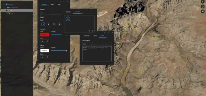
Download for Free – Esri Release ArcGIS Earth 1.4
Recently Esri 3D team has announced the release of ArcGIS Earth 1.4. ArcGIS Earth 1.4 introduces great new features that will enhance workflows for visualizing data, accessing portals, and sharing across
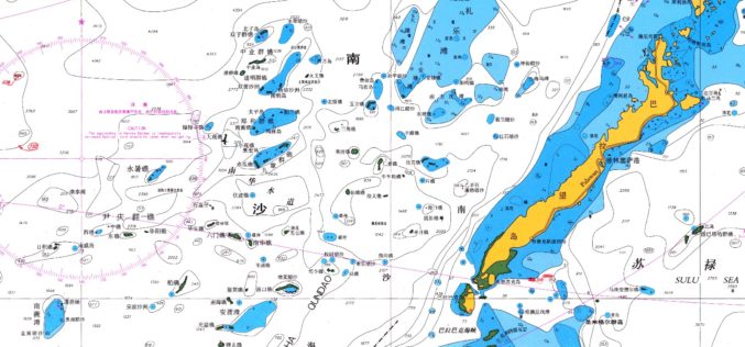
East View Expands South China Sea Imaging Capabilities
MINNEAPOLIS, Minn. – January 31, 2017 – East View Geospatial is enthusiastic to announce the expansion of analytic services in the South China Sea for foundation data and satellite imagery.
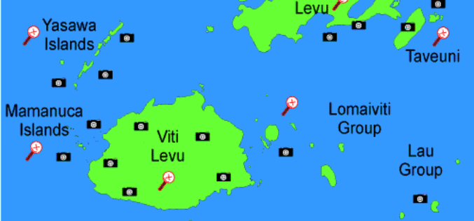
Fiji Adopted GIS to Help in Improving Natural Disaster Risk Development
According to the recent news reported by The Fiji Times Online, the office of the Commissioner Western will have access to information which will help in the visualization of the
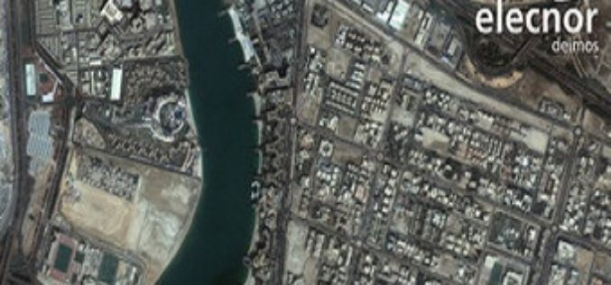
Ordnance Survey International Helps the UAE Manage Climate Change
Ordnance Survey International and Deimos Space UK are to work with the Mohammed bin Rashid Space Centre in Dubai to help the United Arab Emirates (UAE) improve how it plans and

Mapping & Geospatial Industry in India to Grow Manifold in a Decade
Hyderabad – PTI – The mapping and geospatial technology area in the country are estimated to witness business of a whopping Rs 1 lakh crore in the next 10 years, Surveyor

HazardHub Democratizes Hazard Risk Data with New API
For the first time, geographic risk data is available via a real-time API for inclusion to clients’ internal systems. San Diego, CA (PRWEB) January 17, 2017 – HazardHub, the nation’s first
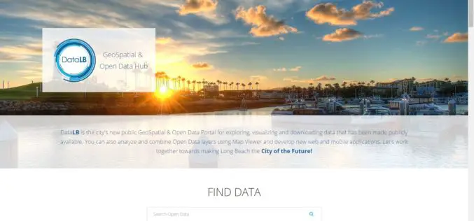
City of Long Beach Launched GeoSpatial & Open Data Portal
Long Beach One of First Cities in U.S. to Display Open Data in Geospatial Data Format The City of Long Beach launched DataLB, the City’s new Open Data Portal on
