
Tag "geospatial"

Timmons Group Webinar | Squashing Zika with GIS!
Squashing Zika with GIS! Thursday, January 26th | 2 – 3 pm EST Timmons Group is a leading provider of geospatial information architecture and engineering services throughout the United States and
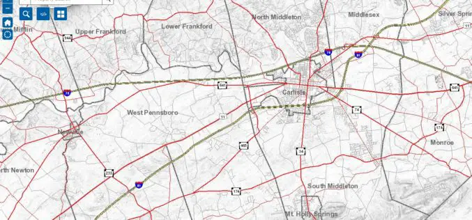
Cumberland County Launches New Property Mapper Application
Cumberland County, PA, January 3, 2017- At their public meeting today, the Cumberland County Board of Commissioners announced the release of a new online property mapper application now available to

Maharashtra Forest Dept Gets New GIS Based Command Centre to Monitor Forest Reserve
Maharashtra – According to recent news by The Hindustan Times, in a first for the country, the Maharashtra State Forest Department will use real-time satellite images of all forested areas
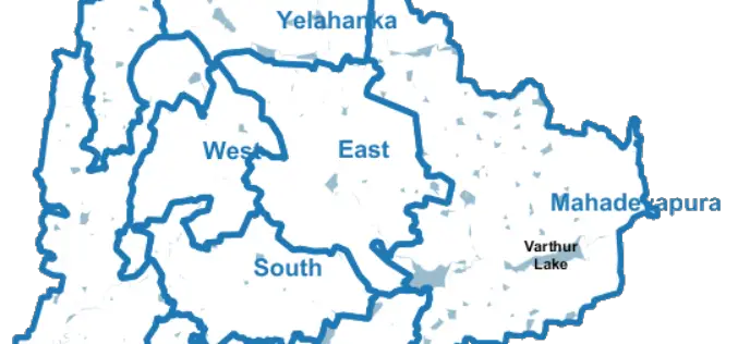
Bengaluru City to Have Geospatial Enabled Property Tax Information System
According to recent news by the Time of India, the online platform for property tax management has been set up by Bruhat Bengaluru Mahanagara Palike (BBMP) in association with the Indian

Illinois Wesleyan University Selects Geospatial Corporation’s GeoUnderground and GIS-Centric Smart-Asset Management Technologies
GeoUnderground Deployed to Improve Infrastructure Capital and Business Planning Pittsburgh Pennsylvania – December 19, 2016– Geospatial Corporation (OTCQB Symbol “GSPH”), a leading innovator of asset management/analytics/mapping software and 3D mapping
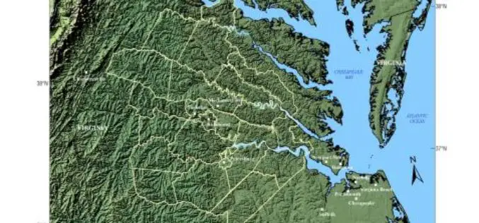
USGS -Building Unified Geospatial Data for Land-Change Modeling—A Case Study in the Area of Richmond, Virginia
Building Unified Geospatial Data for Land-Change Modeling—A Case Study in the Area of Richmond, Virginia Abstract – An effort to build a unified collection of geospatial data for use in
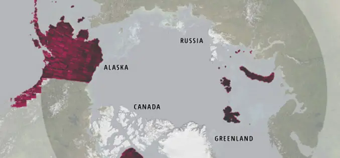
Esri Releases New Arctic Elevation Data
ArcticDEM Provides New Insight into Effects of Climate Change and Enables Communities to Take Early Action Redlands, California—Global smart-mapping leader Esri and the ArcticDEM project, a public-private initiative to produce
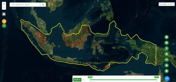
Indonesia Launches Geospatial Portal for Forest Monitoring and Protection
Indonesia – According to recent news by the Eco-Business, the Ministry of Environment and Forestry has launched a new geospatial portal, which will serve as the dedicated and reliable source
Boundless Introduces Open GIS Platform for the Enterprise
Boundless, a leader in open GIS, introduced an open GIS ecosystem to unlock the business intelligence of location-based data. In response to market demand for more open and scalable GIS

OGC Requests Public Comment on its Coverage Implementation Schema – ReferenceableGridCoverage Extension
The Open Geospatial Consortium (OGC®) seeks public comment on the OGC Coverage Implementation Schema (CIS) – ReferenceableGridCoverage Extension. A referenceable grid is associated with information that allows the location of
