
Tag "geospatial"

LISTECH Releases New Upgrade for Geospatial Software Neo
Melbourne, Australia, 28 November 2017 – LISTECH, a world leader in development of smart software solutions for the surveying, civil engineering and land related information industries today announced the latest

Microsoft launches Azure Location Based Services for Geospatial Needs Across Industries
Together with an ecosystem of partners, Microsoft’s cloud offers enterprise customers choice and options for using location data to solve issues such as asset location tracking, fleet management and traffic congestion. REDMOND,
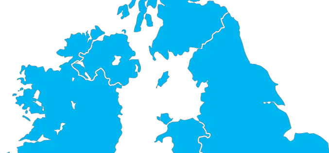
UK Announces New Geospatial Commission
Chancellor announces new Geospatial Commission to maximise the value of all UK government data linked to location. UK – November 22, 2017 – The Chancellor has announced today a new Geospatial
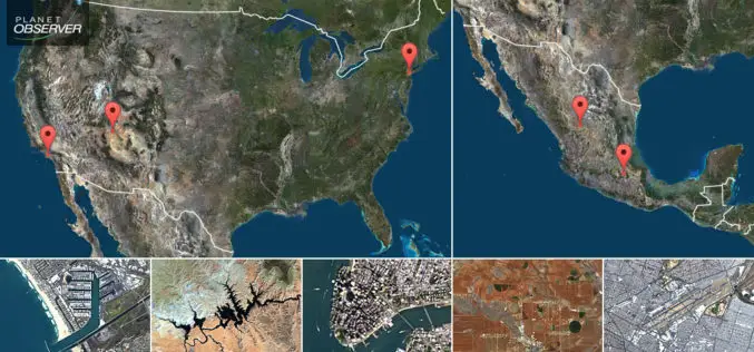
PlanetObserver Presents New PlanetSAT Updates Imagery Basemap of the United States and Mexico
Clermont-Ferrand, France – April 26th 2017 – The French company PlanetObserver, specialized in geospatial data production, has just finalized the new PlanetSAT Updates imagery basemap of the United States and

Pix4D Partners with Kokusai Kogyo in Japan to Deliver a 3D Geospatial Analysis Cloud Service
Full automation for 3D spatial analysis that support i-Construction and public surveying November 20, 2017 – Pix4D is partnering with Kokusai Kogyo Corporation (KKC)—the leading geospatial consulting company in Japan–to deliver

OGC Calls for Participation in its ‘Geospatial to the Edge’ Interoperability Plugfest
November 21, 2017 – The Open Geospatial Consortium (OGC) is calling for interested participants in its ‘Geospatial to the Edge’ Interoperability Plugfest. OGC Plugfests, initiatives of the OGC Innovation Program, provide
Esri Supports the Geospatial Data Act
Legislation Provides Significant Step toward National Collaboration among the GIS Community November 16, 2017 – Redlands, California—Esri, the global leader in spatial analytics, today applauded Congress in introducing the Geospatial Data

IIC Technologies Earns CMMI Level 3 Appraisal
IIC Technologies, has further strengthened its position as one of the reliable and efficient geospatial software solutions and service provider, by being appraised at CMMI maturity level 3. Both waterfall
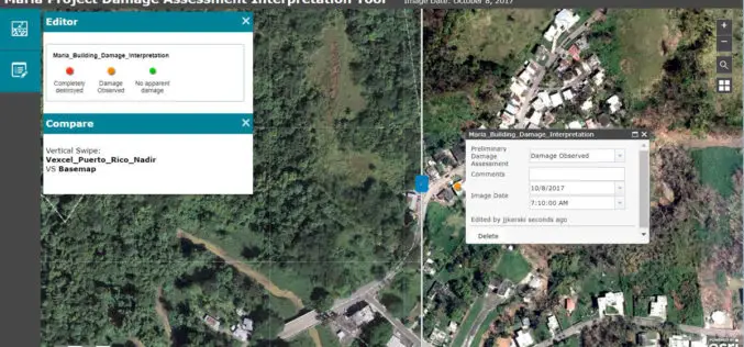
Esri Provides Mapping Technology for Students to Assess Hurricane Damage
Schools Can Use High-Resolution Imagery to Identify Where Help Is Needed to Rebuild in Puerto Rico November 9, 2017, Redlands, California – Esri, the world leader in spatial analytics, today announced it

Woolpert Contracted for $1.7M University Field House
The firm was contracted by Mecklenburg County to design this shared facility that will benefit both county residents and students at Queens University. CHARLOTTE, N.C. (Nov. 3, 2017) — Woolpert
