
Tag "GIS"
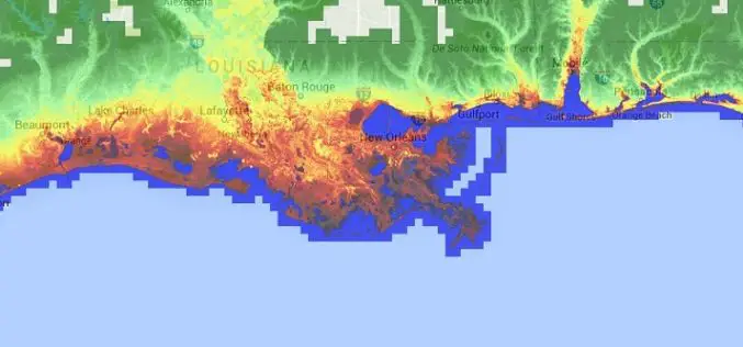
Accuracy Comparison of Publicly available DEMs and LiDAR DEM for Coastal Flood Risk Assessments
Coasts are experiencing the adverse consequences of hazards related to climate change and sea level rise and will be exposed to increasing risks of coastal flooding. Ten percent of the
Increase the Return on Your GIS Investment with GIS-Lite Applications
Increase the Return on Your GIS Investment with GIS-Lite Applications July 14, 2015 12:00-12:30 PM ET Deliver self-contained, interactive maps and lightweight GIS applications available to all end users with

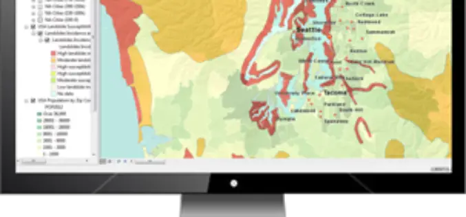
New State Map from Indiana Geological Survey Makes Use of High-Res Imaging
BLOOMINGTON, Ind. — The Indiana Geological Survey has published a new state map that features the latest digital technology using high-resolution elevation data. The map was prepared using lidar data
Celebrate Google Earth 10 Birthday with Two New Features
Happy Birthday, Google Earth! It has been a full decade to the launch of Google Earth, has provided the capability to visualize and analyze geographic data for various scientific applications
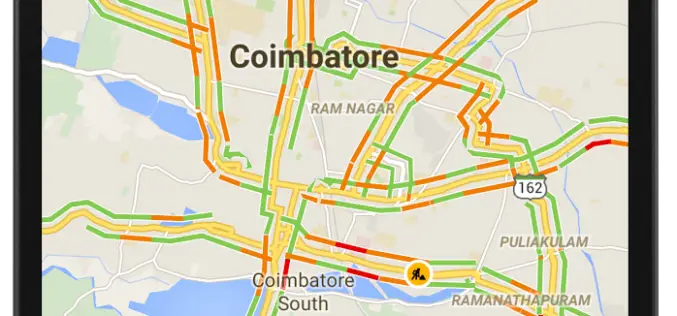
12 Cities in India to Get Live Traffic Updates Through Google Map
Never miss your flight or train, use Google Map to get real time traffic updates to route your drive around the traffic and save your time. Google has launched the

Amazon Web Services – City on a Cloud Innovation Challenge 2015
Amazon Web Services simplifies IT workloads that governments struggle with every day, making it easier to deploy and manage the technology our customers depend on, such as Geographical Information Systems

OGC Seeks Public Comment on OGC Web Coverage Service – Transaction Operation Extension
The OGC membership seeks public comment on the candidate OGC® Web Coverage Service (WCS) – Transaction operation extension, version 2.0. The OGC Web Coverage Service (WCS) Interface Standard is an
OpenGeo Suite 4.6.1 Now Available
Boundless is announcing the general availability of OpenGeo Suite 4.6.1 for all customers and OpenGeo Suite users. This is a patch release primarily intended to address an identified security vulnerability
Boundless Certifies Latest QGIS Release with OpenGeo Suite
Commercially Supported Instance of QGIS 2.8.2 Available with Custom Plugins for Superior Usability and Cost-Effectiveness Aimed at Enterprise Users New York, NY & Washington, DC – June 17, 2015 —
Medea S.p.A., Italy Chooses SuperGIS for Pipeline Service Management
Supergeo Technologies, the leading GIS software provider,announces that Medea S.p.A., Italy selects SuperGIS Desktop and SuperGIS Server to manage its pipeline management for enhancing citizens’ life quality. Having 30-years experience,
