
Tag "GNSS"
European GNSS Agency And Thales Launch EDG²E, A Dual-Frequency Multi-Constellation Receiver
According to recent news reported by the GPS World, together the European GNSS Agency (GSA) and Thales has launched a equipment for dual frequency Galileo, GPS and EGNOS project (EDG²E). The four-year-long
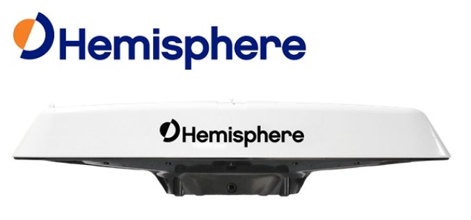
Hemisphere GNSS Announces New Atlas®-Capable, Multi-GNSS Vector™ V123 & V133 Smart Antennas
LONDON, UK – March 14, 2018 – Today from the Oceanology International exhibition and conference in London, UK, Hemisphere GNSS announces the new single-frequency, multi-GNSS Vector V123 and V133 all-in-one

Applanix Introduces its Autonomy Development Platform for Accelerating Research, Development, and Production of Autonomous Vehicles
Richmond Hill, Ontario, January 23, 2018 — Applanix, a Trimble Company and leader in positioning and orientation technology, introduced today its Autonomy Development Platform to provide automakers, truck makers, and Tier 1
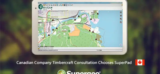
Canadian Company Timbercraft Consultation Chooses SuperPad
The global GIS software provider, Supergeo Technologies Inc., is excited to announce that the Canadian consulting firm Timbercraft Consultation Inc. selects SuperPad to record spatial data. Specialized in geographic data
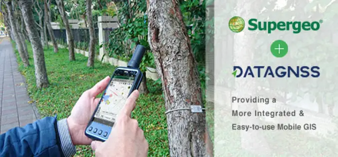
Supergeo Teams up with DataGNSS to Provide a Cost-effective RTK Solution
Supergeo is delighted to announce that the directors of DataGNSS, a professional GNSS RTK device manufacturer, have visited Supergeo’s Taipei Headquarters at the beginning of December 2017. In the meeting,

Launch of China’s New-Generation Beidou-3 Navigation Satellites
November 5, 2017 – According to recent news, China has successfully launched two navigation satellites – namely the Beidou-3M1 (Beidou-24) and Beidou-3M2 (Beidou-25) navigation satellite using a Long March-3B/YZ-1 rocket. The satellites are
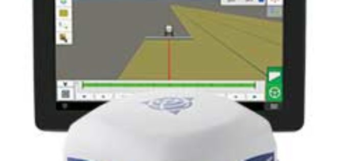
Trimble Introduces ISOBUS-Compatible GFX-750 Display System with Advanced Guidance Controller for Agriculture Applications
Enhanced Connectivity with Integrated Wi-Fi and Bluetooth Communications SUNNYVALE, Calif., Oct. 30, 2017—Trimble (NASDAQ: TRMB) introduced today the Trimble® GFX-750™ display system for agriculture applications. The display system comes with

Japan Successfully Launches 4th Satellite of Quasi-Zenith Satellite System (QZSS)
October 10, 2017 – Mitsubishi Heavy Industries, Ltd. and JAXA successfully launched H-IIA Launch Vehicle No. 36 (H-IIA・F36) which encapsulates MICHIBIKI No. 4, Quasi-Zenith Satellite System; at 7:01:37a.m., 2017 (JST) from

Trimble GNSS Smart Target Base Station Provides Simplified Map Production from UAVs
High-Performance GNSS Reference Station and Ground Control in One Easy-to-Deploy Package BERLIN, Sept. 26, 2017—Trimble (NASDAQ: TRMB) announced today the release of the Trimble® GNSS Smart Target Base Station for

Indian Railways to Install GPS in all Hand-pushed Trolleys Used for Track Inspection
September 8, 2017 – PTI – The railway ministry has decided to install GPS trackers in all hand-pushed trolleys used to inspect the tracks. In a letter to all zonal
