
Tag "GNSS"
Japan Launches Satellite Carrying Its Own Version of GPS
Japan has recently launched a rocket carrying a satellite with a local version of the US global positioning system (GPS) (Quasi-Zenith Satellite System) on Thursday (June 1, 2017), which is expected

Enjoying the High-Accuracy Positioning with the Latest SuperPad 10
The first stable version of SuperPad 10 has been released for over one and a half months. In the first release, SuperPad 10 not only already equips with numerous practical
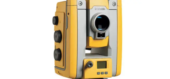
Trimble’s New Total Station Provides Millimeter Accuracy for Monitoring Applications
Trimble S5 Ti-M Features FineLock Technology—Locks onto Targets with Precision in Congested Work Areas SUNNYVALE, Calif., April 12, 2017—Trimble (NASDAQ: TRMB) announced today the release of a new monitoring device,

Next SuperSurv 10 Release Will Add Powerful Features
Equipped with advanced GIS and GNSS technologies, SuperSurv 10 is a cutting-edge mobile GIS app that operates on Android OS. After installing SuperSurv 10, field surveyors only need to bring
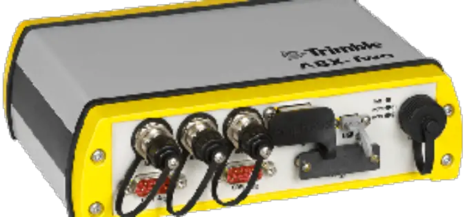
Trimble Introduces Compact, High-Performance OEM GNSS Sensor for System Integrators
SOUTHAMPTON, United Kingdom, April 6, 2017—Trimble (NASDAQ:TRMB) introduced today the Trimble® ABX-Two OEM GNSS sensor. The ABX-Two delivers precise heading, pitch, roll and 3D positioning information. With two internal MB-Two
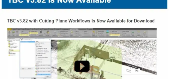
TBC v3.82 is Now Available
TBC v3.82 with Cutting Plane Workflows is Now Available for Download Trimble Business Center (TBC) is a geospatial office software that enables users to complete field-to-finish workflows efficiently and with
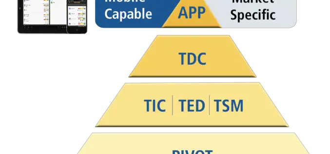
Trimble Incorporates Galileo Support in New Version of its GNSS Infrastructure Management Software
Delivering Higher-Accuracy Positioning To Improve GNSS Network Performance and Reliability SUNNYVALE, Calif., March 27, 2017—Trimble (NASDAQ: TRMB) introduced today version 3.10 of its Trimble® Pivot™ Platform software, a modular solution

Supergeo Announces the Official Release of SuperPad 10
Integrating GNSS and GIS technologies, SuperPad 10 is mobile GIS software designed for Windows and Windows Mobile OS. As one of the most popular mobile software of Supergeo, SuperPad not

Leica Geosystems Partners with Geolantis to Integrate a Cloud Based Utility Mapping Platform
(Heerbrugg, Switzerland; Klagenfurt, Austria, 8 February 2017) – Leica Geosystems, global leader of measurement and digital reality capture technologies, has teamed with Geolantis, a provider and developer of the best-in-class
NovAtel Unleashes Powerful New Positioning Capabilities with the Release of 7.200 Version Firmware
Calgary, Canada, February 2, 2017 – NovAtel’s commitment to precise, ASSURED positioning is central to the launch of our OEM7 7.200 version firmware. Announced today in Calgary, 7.200 firmware introduces
