
Tag "land surface temperature"

Sentinel-3A Sea & Land Surface Temperature Radiometer (SLSTR) Level-1B Data is Now Available at Near Real Time (NRT) Timeliness
Sentinel-3 is primarily an ocean mission, however, the mission will also be able to provide atmospheric and land applications. The mission will provide data continuity for the ERS, Envisat and

First Earth Colour Data Released by Sentinel-3A
20 October 2016 – The Copernicus Sentinel-3A satellite has taken another step towards being fully ‘operational’ as the first data from its Ocean and Land Colour Instrument are made available
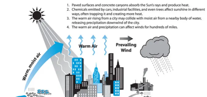
Analysis of the Urban Heat Island Effect in Shijiazhuang, China Using Satellite and Airborne Data
Analysis of the Urban Heat Island Effect in Shijiazhuang, China Using Satellite and Airborne Data – Kai Liu, Hongbo Su, Lifu Zhang, Hang Yang, Renhua Zhang and Xueke Li Abstract: The urban heat island (UHI)

Urban Surface Temperature Time Series Estimation at the Local Scale by Spatial-Spectral Unmixing of Satellite Observations
Urban Surface Temperature Time Series Estimation at the Local Scale by Spatial-Spectral Unmixing of Satellite Observations – Zina Mitraka, Nektarios Chrysoulakis, Georgia Doxani, Fabio Del Frate and Michael Berger Abstract: The study of urban

Estimation and Validation of Land Surface Temperatures from Chinese Second-Generation Polar-Orbit FY-3A VIRR Data
Estimation and Validation of Land Surface Temperatures from Chinese Second-Generation Polar-Orbit FY-3A VIRR Data – Bo-Hui Tang, Kun Shao , Zhao-Liang Li, Hua Wu, Françoise Nerry and Guoqing Zhou Abstract: This work estimated and validated
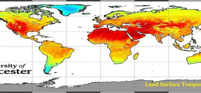
GlobTemperature Project an European Space Agency (ESA) Due Initiative
The European Space Agency (ESA) has launched a new project – GlobTemperature to capture earth land surface temperature (LST) at global scale. Instruments like thermometer there are several satellite sensor
