
Tag "LiDAR"

Echolocation And Its Technological Developments
Authored By: Introduction Dolphins utilize echolocation to discover things in their surroundings. The clicking-noises they utter bounce off things under the water & goes back to this smart mammal.
Bluesky uses Leica CityMapper to capture major UK cities in 3D
Heerbrugg, Switzerland, 21 November 2018 – Leica Geosystems, part of Hexagon, announced today the Leica CityMapper, the world’s first hybrid airborne sensor combining vertical and oblique aerial imagery together with
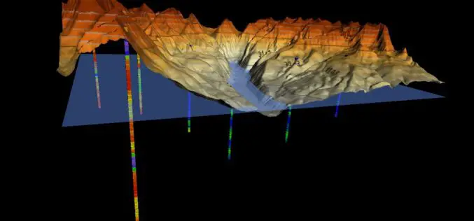
Golden Software Enhances 3D Data Visualization in Surfer 16
GOLDEN, Colorado, 13 November 2018 – Golden Software, a developer of affordable scientific graphics software, has enhanced the visualization capabilities in version 16 of its Surfer® gridding, contouring and 3D

3D Laser Mapping & GeoSLAM Global Merger Announcement
3D Laser Mapping Ltd and GeoSLAM Ltd Merge, Creating a Global Market Leader in Mapping and Monitoring Nottingham, England, 1st August 2018 – Leading UK laser scanning and monitoring companies’ 3D

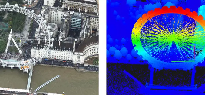
A City in 2 Billion Points
July 31, 2018 – In 2014 the Institut Cartogràfic i Geològic de Catalunya (ICGC) scanned an area of 1900×1200 meters around the La Sagrada Família in the city of Barcelona using
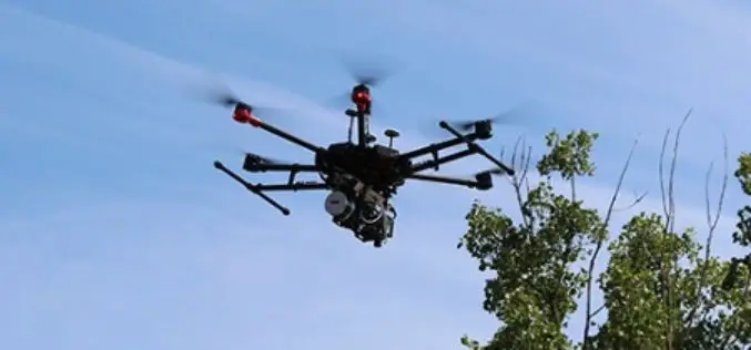
Headwall Integrates Hyperspectral and LiDAR Aboard UAV Platforms
Enabling Remote Sensing Capabilities From Civil Infrastructure Inspection to Crop Monitoring BOLTON, MA, JUNE 11 – Headwall has introduced advanced sensor payloads consisting of hyperspectral sensors and LIDAR for deployment
NAKANIHON and RIEGL to Give Joint Presentation on Helicopter-based Airborne Bathymetric LiDAR Systems
19th JABLTCX workshop, June 26-28, 2018 Providence, Rhode Island, USA: NAKANIHON and RIEGL to Give Joint Presentation on Helicopter-based Airborne Bathymetric LiDAR Systems Horn, June 7, 2018 – After successfully integrating and mobilizing a
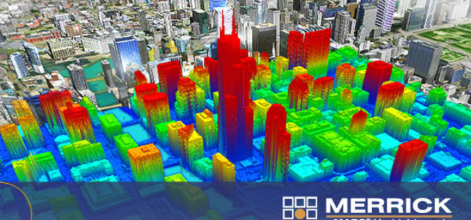
Merrick Releases Version 2018 MARS® Software Suite
May 31, 2018 – Merrick & Company, a global leader in light detection and ranging (LiDAR), digital orthophotography, hyperspectral imaging, and geographic information systems (GIS) data integration, is pleased to
Skyline Software Systems Releases Photomesh™ 7.4 With LiDAR Integration and Improved Aerial Triangulation Capability
Herndon, VA – May 21, 2018 – Skyline Software Systems Inc. announced today that it has released PhotoMesh™ v7.4 software suite as part of its SkylineGlobe products. This update integrates
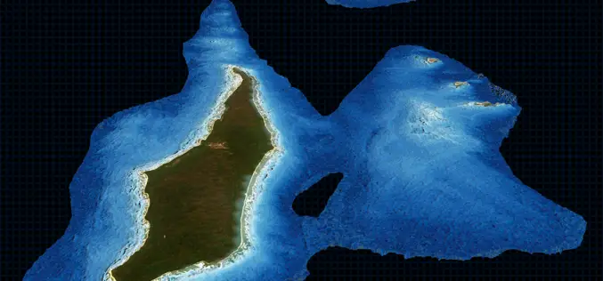
TCarta Delivers Satellite Derived Bathymetry Data to Total for Hydrocarbon Exploration Project
BRISTOL, United Kingdom, 16 May 2018 – TCarta, a global provider of marine geospatial products, has delivered satellite derived bathymetry (SDB) to Total SA, one of the world’s largest oil and gas producers.
