
Tag "Mapping Tool"
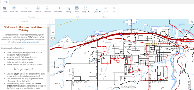
WebMap: Hood River County Releases New GIS Mapping Tool
Hood River County Geographic Information Services (GIS) Department has recently launched unveil a beta version of its interactive online WebMap application. The Hood River County Webmap application and its underlying

Ordnance Survey’s Ground Breaking Planning and Mapping Tool for the National Rollout of 5G Technology
The holly and the 5G Bournemouth’s Christmas tree, lights and decorations feature in Ordnance Survey’s ground breaking planning and mapping tool for the national rollout of 5G technology. Bournemouth’s Christmas tree,
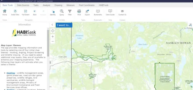
Government of Saskatchewan Launches New Hunting, Angling and Biodiversity Mapping Tool
The Ministry of Environment, Saskatchewan launched a new client-centred, online mapping tool called HABISask (Hunting, Angling and Biodiversity Information of Saskatchewan) that combines new and existing information on hunting, angling,
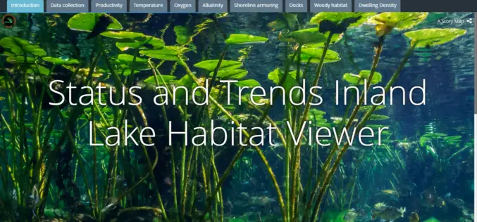
Michigan Department of Natural Resources Launches New Web-based Mapping Tool
The Michigan Department of Natural Resources has recently launched a new web-based mapping tool – the Inland Lake Habitat Viewer – to provide the public with information about the state’s inland lakes.
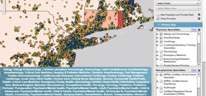
AMA Unveils Enhanced Interactive Mapping Tool Aimed at Helping Health Care Providers
Recently the American Medical Association (AMA) has launched an interactive mapping tool (Health Workforce) to further help physicians and other healthcare providers improve patient access to care. In addition to
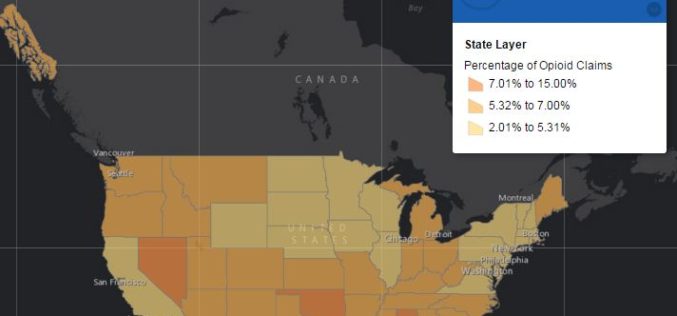
Centers for Medicare & Medicaid Services Has Launched Drug Mapping Tool Available
Interactive online drug mapping tool allows public to search Medicare Part D opioid prescription claims data at the state, county, and ZIP code levels. The Centers for Medicare & Medicaid
