
Tag "PALSAR"
GIS
GIS Data
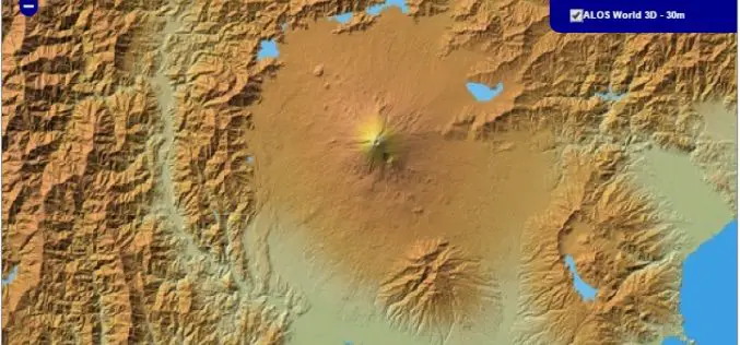
30 meter World Elevation Data is Now Available at JAXA’s Site Free of Charge!
The Japan Aerospace Exploration Agency (JAXA) will begin publishing free of charge an elevation data set that can express undulations of terrain over the world with a resolution of 30
Research Papers
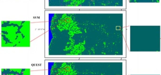
Mapping Oil Palm Plantations in Cameroon Using PALSAR 50-m Orthorectified Mosaic Images
Mapping Oil Palm Plantations in Cameroon Using PALSAR 50-m Orthorectified Mosaic Images -By: Li Li, Jinwei Dong, Simon Njeudeng Tenku and Xiangming Xiao Abstract: Oil palm plantations have expanded rapidly. Estimating either positive
