
Tag "point cloud"

Pix4D is Expanding Globally
Capturing a billion dollar market with advanced computer vision, machine learning, and photogrammetry December 07, 2017 – Pix4D is adding two senior executives to our leadership team to strengthen our global
3DR Webinar: Site Scan Manager Training Webinar
3DR: Site Scan Manager Training Webinar December 6th, at 10:00 AM PT (convert to your timezone) With 3DR continuation to make improvements to Site Scan, the webinar will help you become more
Create Photogrammetric Point Cloud Using Global Mapper Pixels-to-Points Tool
Global Mapper LiDAR Module v.19 Now Available with Pixels-to-Points™ Tool for Photogrammetric Point Cloud Creation November 29, 2017 – Blue Marble Geographics is pleased to announce the release of version 19 of the
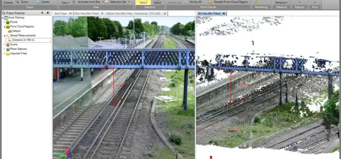
Orbit GT Releases 3D Mapping Feature Extraction Standard v18
Orbit GT launches the 3D Mapping Feature Extraction Standard product version 18. “We’re pleased to announce the release of our second product from the Feature Extraction portfolio”, says Peter Bonne,
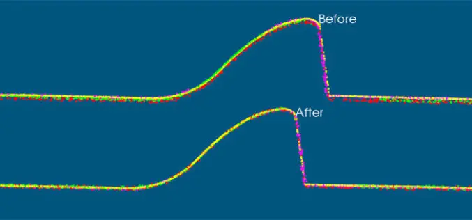
VRMesh V9.5 Available with New Advanced Features for LiDAR Strip Adjustment
Oct. 12th, 2017 – VirtualGrid is pleased to announce the availability of VRMesh v9.5, the latest version of its powerful 3D point cloud and mesh processing software. This new release
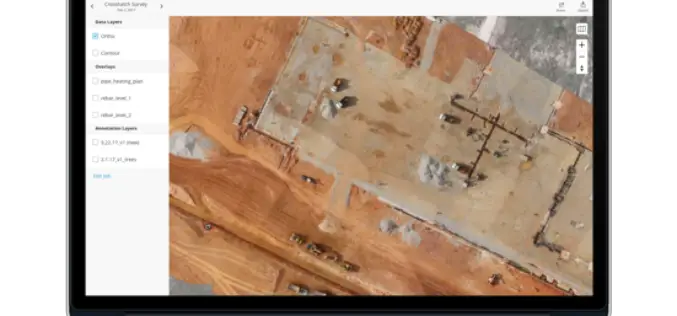
Topcon Announces New Web-Based Service for Mass Data Processing Software
LIVERMORE, Calif., U.S./ CAPELLE A/D IJSSEL, the Netherlands – September 26, 2017 – Topcon Positioning Group announces a new web-based service for integration with the MAGNET® Collage desktop mass data processing
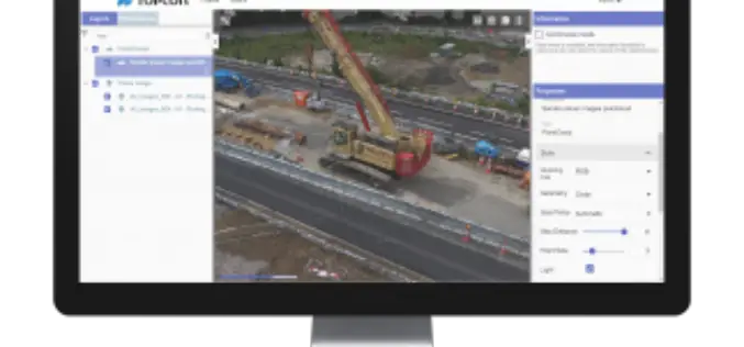
Terra Drone Dedicated Image Processing Software Terra Mapper Begins Sales of Its Cloud Version and Desktop Version at the Same Time
Terra Drone dedicated image processing software “Terra Mapper” begins sales!! ~Cloud version and desktop version release at the same time~ Terra Drone Co., Ltd. (Head Office: Shibuya-ku, Tokyo, CEO: Tokushige
LandScape 7.4: Faster Point Cloud Loading, Change Detection Tools & VR Option
DAT/EM Systems International Updates Landscape Software to Deliver Faster Point Cloud Loading and Change Detection Tools Version 7.4, with Virtual Reality Option, to be Demonstrated at Esri Events in San
Trimble Business Center v3.90 Now Available
Trimble Business Center provides users with the capability to efficiently edit, process, and adjust geospatial data and create deliverables with confidence. The New features/updates included in TBC v3.90: Create, edit,

30 Years of Success Leads DAT/EM to Virtual Reality and UAS
30 Years of Success Leads DAT/EM to Virtual Reality and UAS Anchorage, Alaska, USA. May 10, 2017- In 1987, a group of photogrammetric professionals envisioned a product that would bridge the
