
Tag "remote sensing"

Russia Reduces Reliance on Foreign Remote Sensing Satellite Data
MOSCOW – Russia Space Agency Roscosmos has said that Russia has significantly reduced its dependency on foreign remote sensing satellites. “A significant reduction has been noted in the use of foreign Earth remote
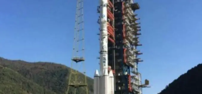
China Launches Gaofen-4 Remote Sensing
The Chinese have closed out the year with the launch of Gaofen-4 Remote Sensing from Long March 3B/G2 rocket. The launch involved the orbiting of a geostationary remote sensing bird,

China Plans to Build Remote Sensing Satellite Network with Global Coverage
China is planning to build a remote sensing satellite network with global coverage by setting up more ground stations overseas. The move will enable China to provide diversified data to foreign
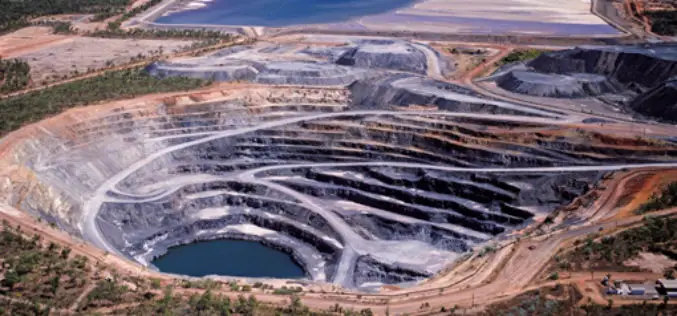
Indian Government Plans to Track Illegal Mining Using Space Technology
NEW DELHI: The government has finalised its plans to track illegal mining in the country using space technology and satellite imagery in partnership with Indian Space Research Organisation (ISRO). This
The First Remote Sensing Atlas to be Launched in SA
SANSA has produced the first remote sensing atlas for the country. The atlas will be launched in 2016. The atlas has been developed to cater for a wide range of

European Space Imaging Wins Additional Supply Contract for the European Commission
Munich, 16/12/15 – European Space Imaging announced today that the company has signed an additional multi-year framework supply contract with the European Commission for the provision of very high-resolution (VHR)
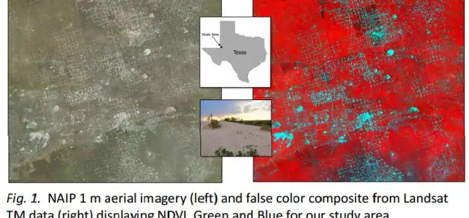
Utilizing Patch Metrics to Improve Classification of Remote Sensing Imagery
Classified remote sensing imagery is used to inform management of various natural resources, though achieving accurate results is a persistent challenge. In particular, some land cover types that are functionally
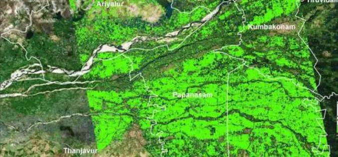
Researchers from TNAU Uses Satellite Images for Crop Management
According to recent news by The Hindu, researchers from Tamil Nadu Agricultural University (TNAU), Coimbatore, have calculated how much-cultivated area was inundated in the recent rains hit hard the costal

ISRO Has Launched Remote Sensing Satellites in Thematic Series, Says Jitendra Singh
New Delhi, India Dec. 9: Union Minister of State for Space Jitendra Singh on Wednesday informed the Lok Sabha that Indian Space Research Organisation (ISRO) has launched Remote Sensing Satellites
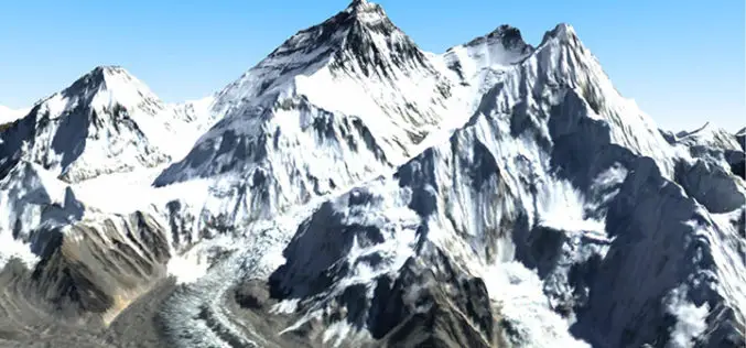
Remote Sensing Technology Reveals that Mount Everest Glaciers Has Shrunk 28% in 40 years
BEIJING: Glaciers on Mount Everest, a source of major Asian rivers like the Brahmaputra, have shrunk by 28 percent over the past 40 years due to climate change, according to
