
Tag "remote sensing"
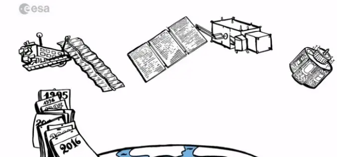
Learn What Sentinel-3 Will Tell Us About Oceans
Most of our planet is covered by oceans, which are directly linked to our weather and climate, and so play a key role in our well-being and economy. Still our

Drones Helping to Conduct High-Resolution Remote Sensing
New York: Earth and environmental scientists are relying on affordable advanced technological drones to conduct long-term high-resolution experiments at a much lower cost than using aircraft or satellites. Unmanned Aerial Vehicles

Combining SAR and Optical Imagery for Mapping and Change Detection
PCI Geomatica Webinar: Combining SAR and Optical Imagery for Mapping and Change Detection February 25, 2016 | 4:00 AM EST – 9:00 AM (GMT) | 2:00 PM EST – 7:00 PM (GMT) PCI

Advanced Webinar on Using NASA Remote Sensing for Flood Monitoring and Management
Advanced Webinar on Using NASA Remote Sensing for Flood Monitoring and Management When: 03/16/2016 to 04/06/2016 Times: 8:00 a.m. – 9:00 a.m. EDT (UTC-4) and 4:00 – 5:00 p.m. EDT (UTC-4)
Drones to Conduct Aerial Surveys of Mines for Coal India
KOLKATA: Coal India is planning to start using drones to conduct aerial surveys of mine blocks that come up for exploration and to assess the extent of greenery restored after

Iran to Build Two Remote Sensing Satellites by 2025
Iran is planning to launch two national remote sensing and telecommunication satellites by 2025. Communications and Information Technology Minister Mahmoud Va’ezi said, “Indigenization of space technologies is the main focus
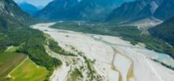
A New Method for Mapping River Properties Using Remote Sensing
A JRC-led article published in Remote Sensing last week presents a new method for mapping river properties using remote sensing. The new method provides a tool for monitoring and characterising the
DigitalGlobe Receives Early Commitments for WorldView-4 Satellite Capacity
Agreements demonstrate demand for high resolution, high accuracy 30 cm imagery from international defense & intelligence customers WESTMINSTER, Colo.–(BUSINESS WIRE)–Jan. 27, 2016– DigitalGlobe, Inc. (NYSE: DGI), a leading global provider

Hyperspectral Narrowband and Multispectral Broadband Indices for Remote Sensing of Crop Evapotranspiration and its Components
Hyperspectral narrowband and multispectral broadband indices for remote sensing of crop evapotranspiration and its components (transpiration and soil evaporation) By: Michael T. Marshall, Prasad S. Thenkabail, Trent Biggs, and Kirk Post
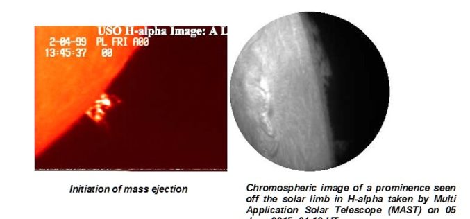
Aditya – L1 First Indian mission to study the Sun
The Aditya-L1 mission was conceived as a 400kg class satellite carrying one payload, the Visible Emission Line Coronagraph (VELC) and was planned to launch in a 800 km low earth
