
Tag "remote sensing"
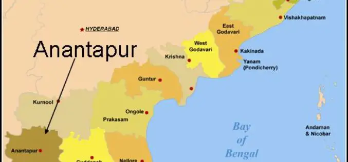
Remote Sensing Reveals Desertification
According to the Deccan Chronicle, a detailed study of satellite pictures over a period of 10 years, from 2002-2012 by Andhra Pradesh State Remote Sensing Applications Centre has revealed an
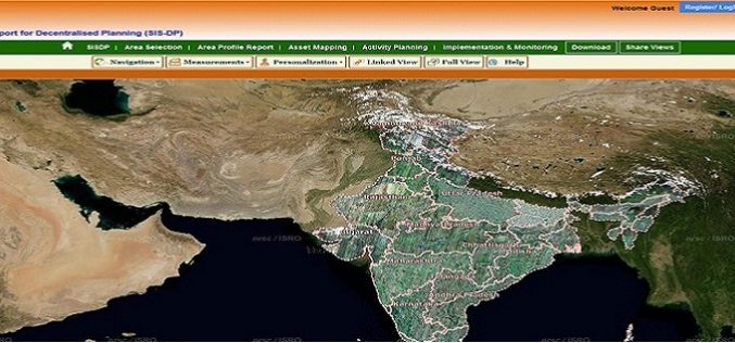
ISRO Empowering Panchayati Raj Institutions using Bhuvan Panchayats
Bhuvan Panchayats Portal plays an important role to disseminate the deliverables of the project including High Resolution Satellite Imagery and Resource Maps at 1: 10,000 scale, to the three levels

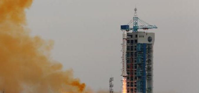
Back to Back – China Launches Yaogan-25 Earth Observation Satellite
According to Xinhua, China has successfully launched the Yaogan-25 remote sensing satellite into a scheduled orbit at 3:33 a.m. on Dec. 11,2014) from the Jiuquan satellite launch center. The remote sensing satellite will
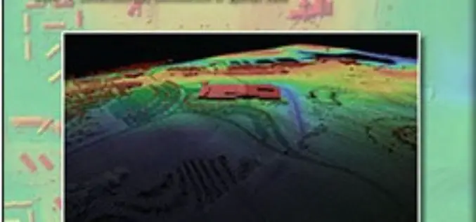
Lidar Base Specification
Lidar Base Specification By Hans Karl Heidemann Abstract In late 2009, a $14.3 million allocation from the “American Recovery and Reinvestment Act” for new light detection and ranging (lidar) elevation
USGS Lidar Base Specification Version 1.2
The US Geological Survey National Geospatial Program is pleased to announce a new version of the USGS Lidar Base Specification that defines deliverables for nationally consistent lidar data acquisitions. The USGS Lidar
3D Laser Mapping Scanner Helps UCL Scientists Map Trees
A state of the art laser scanner purchased from 3D Laser Mapping is helping scientists at University College London accurately monitor and record the state of forests around the world.
China Launches Yaogan-24 Earth Observation Satellite
In recent news, China has successfully launched the Yaogan-24 remote sensing satellite into a scheduled orbit at 3:12 p.m. on Thursday (Nov.20,2014) from the Jiuquan satellite launch center. The remote sensing

eCognition Essentials-Powerful Out-of-the-Box Land Cover Mapping Solution
eCognition Essentials is a new software solution for geospatial and remote sensing professionals performing land cover mapping tasks using imagery. eCognition Essentials offers an intuitive image analysis solution that allows users

Vietnam Completes Spatial Database of Entire Territory
According to news published in Vietnamnet, Vietnam has completed the spatial database of country’s entire territorial waters, including Hoang Sa (Paracel) and Truong Sa (Spratly) archipelagos. The database have multi-temporal satellite

Ten Ways Remote Sensing Can Contribute to Biodiversity Conservation
WCS, NASA, And other conservation and remote sensing agencies, universities and NGOs focus on top 10 conservation questions for satellite technology Remote sensing has and can continue to play a
