Night time Light Images Plays Important Role in Monitoring Humanitarian Crises
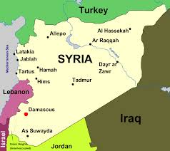
The administrative map of Syria
An interesting research paper recently published in the International Journal of Remote Sensing, gives emphasis on the credibility of night time light images in monitoring humanitarian crises, such as that unfolding in Syria.
The research paper titled “Can night-time light images play a role in evaluating the Syrian Crisis?”- Xi Li and Deren Li, investigates whether night-time light images acquired from the Defense Meteorological Satellite Program’s Operational Linescan System provide spatial and temporal insight with regard to the humanitarian aspects of the Syrian crisis.
The harsh conditions on the ground make it really dangerous and difficult for reporting and accounting of war damage. Satellite can play an important role in monitoring the present situation as well as in making better decision such as deployment of soldiers to a strategically important place as well as real time analysis of troop movements rather than document abuses after they happen. By combining information from citizen journalists and satellite imagery the world can be alert of an attack on civilians before the boots come in action. Therefore satellite images, as one of the few sources of objective information, are potentially of great importance.
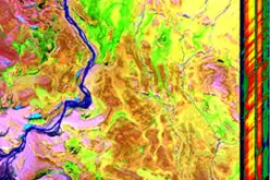
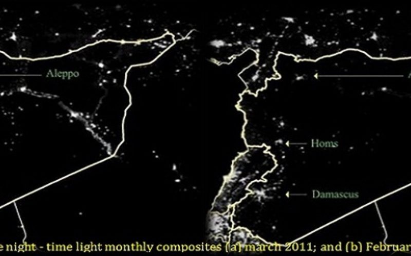
TRES 35-18 Syrian night-light (Image credit: International Journal of Remote Sensing)
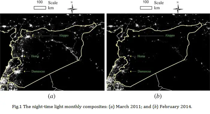
The ongoing Syrian Crisis, which broke out in April 2011, has been a severe humanitarian disaster, with more than 190,000 deaths since the start of the conflict. In this study, Xi Li and Deren Li analysed the effect of the Syrian Crisis on levels of night-time light as a means of evaluating and monitoring the conflict. By comparing the levels of light in March 2011 and February 2014, (see Fig 1) they found that in all of the provinces, the levels of night-time light had declined sharply following the breakout of the conflict. Indeed, in most provinces, the level of night-time light decreased by more than 60%.
The study also suggests that the international border of Syria is a boundary to the night-time light variation patterns, reproving that the administrative border has the effect of socioeconomic discontinuity.
This research provides a primary evaluation of the night-time light data for the Syrian crisis, more information can be discovered by the use of night-time light images in future studies. For example, night-time light variations in control zones of different groups, including the Assad regime, Free Syrian Army, Kurds, and the Islamic State of Iraq and al Shams, can be investigated to evaluate humanitarian situations in these regions. Additionally, by the use of night-time light images, we can also study how the Syrian Civil War has spread to Iraq, where the Islamic State of Iraq and al Shams is now the global focus.
Related Article:
Remote Sensing of South Sudan’s Civil War