
Tag "remote sensing"
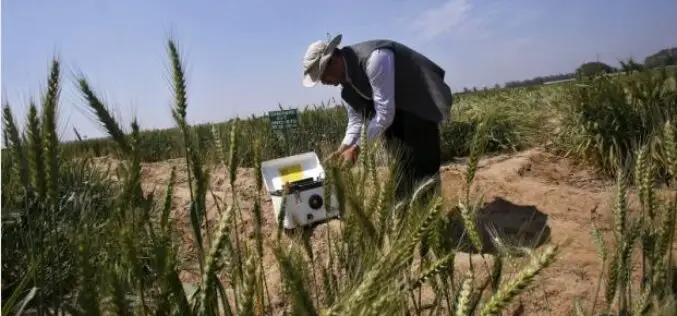
India Turns to ‘Satellite God’ for Crop Monitoring
(Reuters) – Sher Singh, a farmer from desert state of Rajasthan, prays to Varuna, the Hindu god of water, for a bountiful harvest. Now, he is also looking to the

Ph.D. in Remote Sensing of Vegetation at University of Wisconsin-Madison
The University of Wisconsin-Madison is one of the major research universities in the United States. It ranks 2nd in research expenditures among all U.S. universities and first among public universities.

RMIT University is Offering Doctorate, Master and Diploma Courses in Geospatial Science
RMIT is a global university of technology and design. Founded in 1887, it is now the nation’s largest tertiary institution, with 74,000 students. RMIT has three Melbourne campuses, two campuses
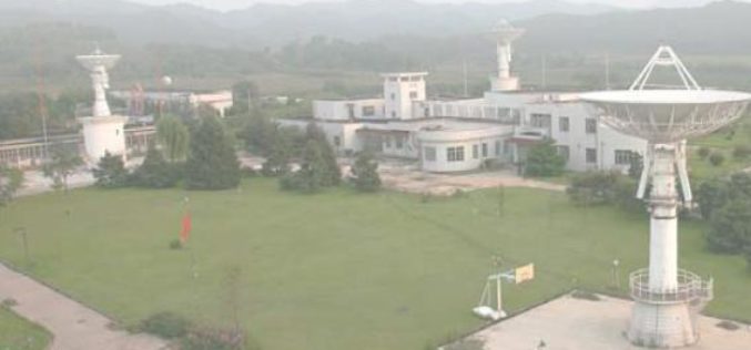
China to Setup Satellite Data Receiving Station in the Arctic
In a recent news by CRI English, China is working to setup its first overseas satellite data receiving station in the Arctic. The station, which is expected to start operation
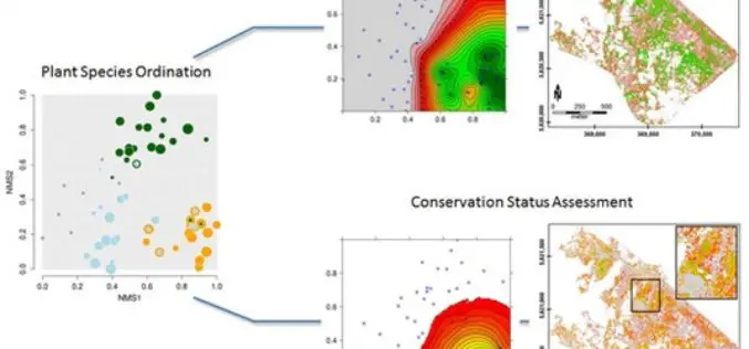
Gradient-Based Assessment of Habitat Quality for Spectral Ecosystem Monitoring
Gradient-Based Assessment of Habitat Quality for Spectral Ecosystem Monitoring – Carsten Neumann , Gabriele Weiss, Sebastian Schmidtlein, Sibylle Itzerott, Angela Lausch, Daniel Doktor, and Maximilian Brell Abstract: The monitoring of ecosystems alterations has become a crucial
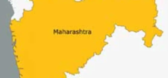
Remote Sensing Centre to Zero-In On Water Sources in Maharashtra
March 05, 2013 – The Maharashtra Remote Sensing Application Centre will launch a web-based GIS of public drinking water sources in the state. The project will also involve creating a
Workshop on Approaches to Remote Sensing For Vegetation Biomass Estimation
Workshop on Approaches to Remote Sensing For Vegetation Biomass Estimation February 24-26, 2015, Brisbane, Australia Vegetation biomass is a crucial ecological variable and an important component of the global carbon
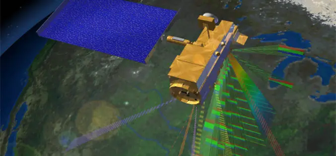
Remote Sensing Technology to Prevent Outbreak of Diseases
Feb. 16, 2015 – Satellites can help scientists follow parasites and viruses, and in some cases predict months ahead of time an outbreak of dengue fever or malaria, researchers said
Specialization course in Geospatial Technologies for Archaeology
The ArcLand partner Incipit – Instituto de Ciencias del Patrimonio (Institute of Heritage Sciences, Spain), in collaboration with the Mérida Institute of Archaeology, announces the launching of a new edition of

Exelis Webinar: Increase Agricultural Efficiencies Using Satellite Imagery
Exelis Webinar on Increase Agricultural Efficiencies Using Satellite Imagery February 5, 2015 As anyone living in a major drought region will tell you, water has become the new gold. Properly conserving and
