
Tag "remote sensing"
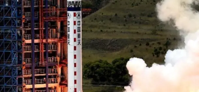
China Launches New Remote Sensing Satellite
In recent news,China has successfully launched a Yaogan-23 remote sensing satellite into scheduled orbit that will help in scientific experiments, natural resource surveys, crop yield estimates and disaster relief measures. The

Land Applications of Radar Remote Sensing
The aim of this book is to demonstrate the use of SAR data in three application domains, i.e. land cover (Part II), topography (Part III), and land motion (Part IV).
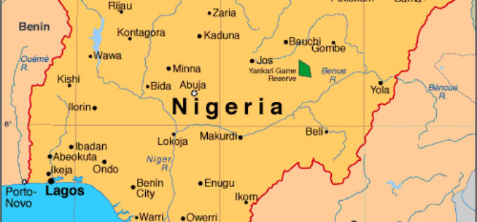
Government of Nigeria to Use Space Technology to Tackle Environmental Challenges
According to WorldStage Newsonline, The Federal Government of Nigeria is set to reposition space technology to tackle environmental challenges. Director of the National Centre for Remote Sensing (NCRS), Mr. Effron

PhD in Earth Observation and Remote Sensing at The University of Tromsø
The University of Tromsø – The Arctic University of Norway. Located in the city of Tromsø, Norway, it was established in 1968, and opened in 1972. It is one of eight
Can Night-time Light Images Play a Role in Evaluating the Syrian Crisis?
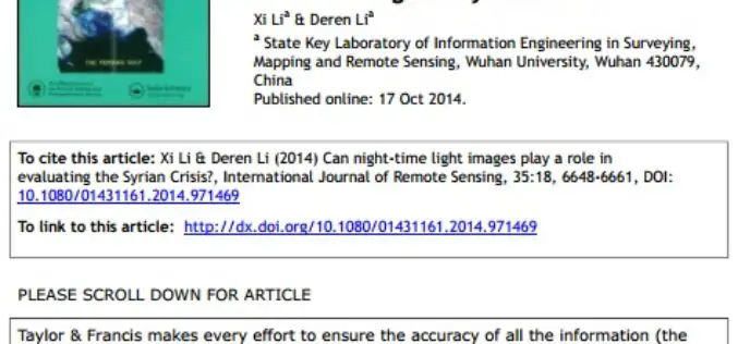
Can night-time light images play a role in evaluating the Syrian Crisis? Xi Lia & Deren Lia a; State Key Laboratory of Information Engineering in Surveying,Mapping and Remote Sensing, Wuhan University, Wuhan 430079,China
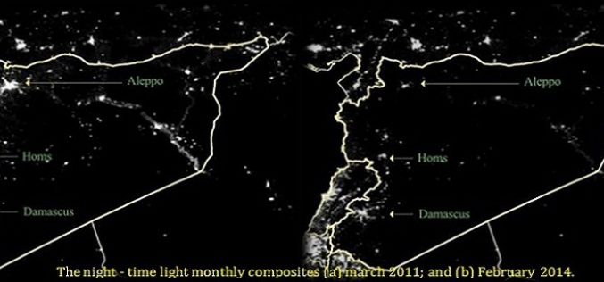
Night time Light Images Plays Important Role in Monitoring Humanitarian Crises
An interesting research paper recently published in the International Journal of Remote Sensing, gives emphasis on the credibility of night time light images in monitoring humanitarian crises, such as that
Investigation of Ground Remote Sensing Techniques for Supporting an Early Warning Water-Leakage System
Investigation of Ground Remote Sensing Techniques for Supporting an Early Warning Water-Leakage System Athos Agapiou, Dimitrios D. Alexakis, Kyriacos Themistocleous, Apostolos Sarris,Skevi Perdikou, Chris Clayton and Diofantos G. Hadjimitsis The decrease of water

Two Publications on How to Best use Remote Sensing Data at a 1-km scale
The NCEAS Environment and Organisms Working Group set about to assemble a state-of-the-art set of environmental layers that incorporate well-known but rarely used measures that have direct links to
University of Kerala Announces Admission to PG Diploma in Geo-Information Science and Technology
UNIVERSITY OF KERALA Centre for Geo-Information Science and Technology (A centre of excellence supported by the DST and KSCSTE) Announces admission to the PG
China Launches Remote Sensing Satellite – Yaogan-21
In recent news,China has successfully launched Yaogan-21, a remote sensing satellite on September 8, 2014 from Taiyuan Satellite Launch Centre. A Long March-4B carrier rocket carries Yaogan-21 and Tiantuo-2 satellite,
