About Author

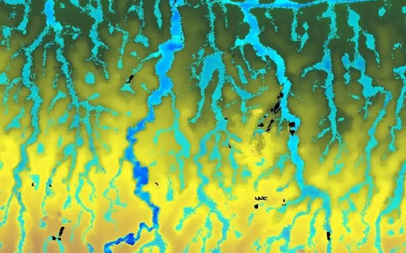
When it comes to modeling anything on the earth’s surface, having an understanding of ground level is key. Computer-generated terrain models are known as Digital Elevation Models (DEMs), and are particularly important when it comes to building flood models at a regional, national, or even global level. Historically, this has been done using satellite-derived terrain data from NASA’s Shuttle Radar Topography Mission (SRTM), which is now over 20 years old and as a result is no longer fit for purpose.
To level up the playing field for DEM users, in 2022 flood modeling experts Fathom built and released FABDEM (Forests And Buildings removed Copernicus DEM) in a collaboration with the University of Bristol. The improvements in FABDEM have the potential to change modeling of flows across the land surface, as well as many engineering applications including remote surveying and planning of infrastructure projects.
What is FABDEM?
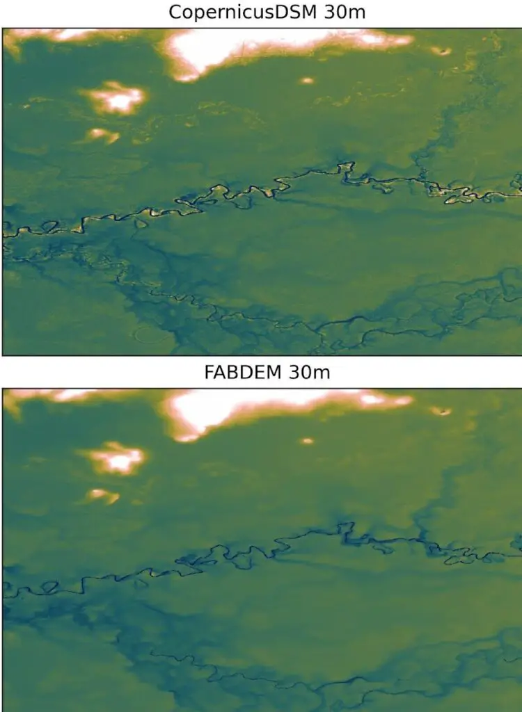
Copernicus Global 30m DEM is currently the most accurate, freely available DEM, however, it represents elevation including buildings and vegetation. This is a problem for anyone looking for models that represent ‘ground level’ (also called ‘bare earth’). FABDEM is based on Copernicus DEM and removes vegetation and buildings to allow for a bare earth model.
The methodology to produce FABDEM has been published in a peer-reviewed journal, and it has been made available commercially for flood modeling, its initial purpose, and for applications across all geospatial use cases.
Copernicus Global 30m
Availability of Different Global and Local DEMs
Digital Elevation Models generally fall into two categories: satellite-derived global or regional DEMs, and local DEMs, most of which use LiDAR technology. The high-quality LiDAR DEMs can have centimeter-scale accuracy, so are undeniably the best choice for local studies where they are available. However, LiDAR DEMs only cover a tiny fraction of the globe and it would be prohibitively expensive to build LiDAR on a complete global scale. So, at large scale, improvements in global DEMs drive progress in many types of modeling.
Using LiDAR as ‘truth’
Under the hood of the FABDEM processing is a machine learning algorithm. This takes high quality LiDAR data as truth and trains our model to correct the Copernicus DEM elevations to more closely match the LiDAR. Several ’predictor’ datasets also drive this algorithm. By correlating these data with the vegetation and building height anomalies in the Copernicus DEM, our model is able to learn the relationships between predictors and the correction needed to produce a ‘bare earth’ DEM.
Comparisons with FABDEM
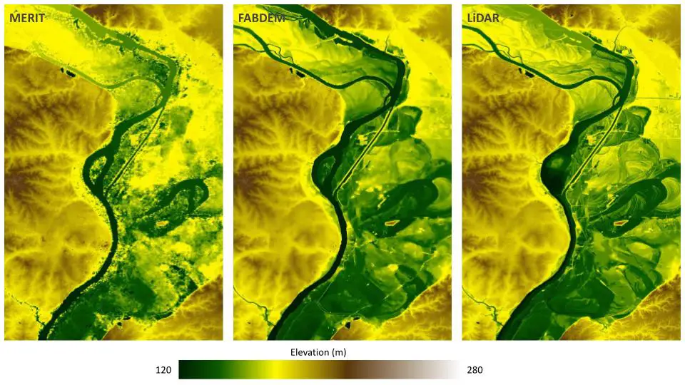
To determine how good our new FABDEM dataset is, we firstly want to compare it against LiDAR DEMs as our best known representation of ground truth elevation. Secondly, we compare against other global DEMs with similar use cases to FABDEM. As the only other publicly available global DEM that removes forest heights alongside other errors, MERIT DEM is the closest conceptually to FABDEM. Our comparison against MERIT found FABDEM had lower errors than MERIT when compared to the LiDAR data. Importantly, spatial inspections also show clearer representations of features in the landscape in FABDEM.
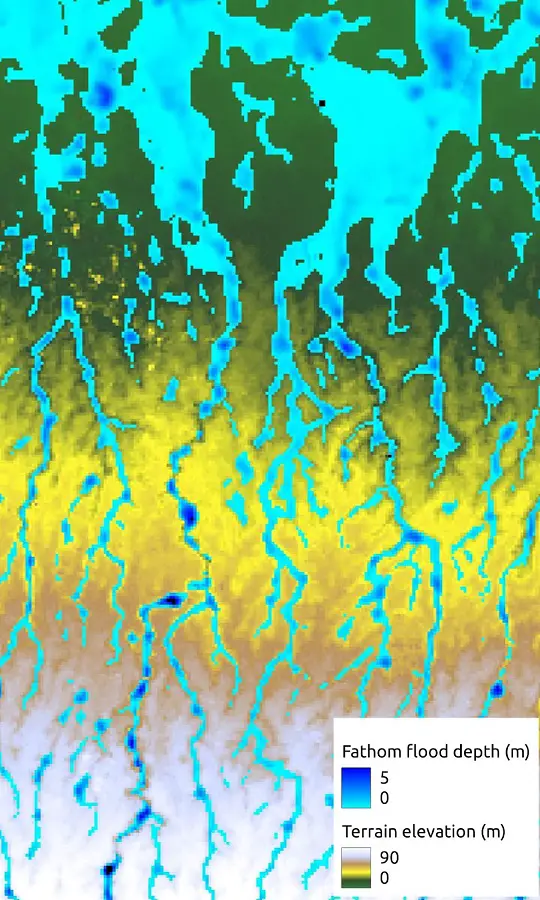
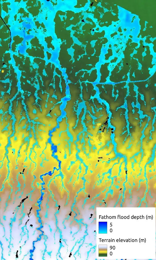
When translated into a real world application of FABDEM, flood mapping (which is our expertise at Fathom), these improved representations of terrain features directing the flows of water mean a better quality flood map, and hence, a better understanding of who’s at risk of flooding.
FABDEM: So What?
In essence, FABDEM gives you a true picture of the earth’s terrain. Meaning that if you have a use that requires a realistic 3D simulation of the earth, then FABDEM will be valuable. At Fathom, we use it to understand the behavior of natural perils at large scale, but flood mapping is just one small niche of the many applications of DEMs.
We are just starting to see the potential benefits of FABDEM beyond flood modeling: from allowing remote engineering site surveys to guiding site selection for infrastructure and agriculture projects, developing artificial worlds for gaming, and studying animal migration patterns.
If you are interested in the data or know of an unusual use case that we may not have heard of, please get in touch. You can download the research for free here or you can learn more about Fathom’s options for licensing here.
About the author:
Dr Peter Uhe, Senior Developer, Fathom
Dr Uhe has over a decade of experience working in academia and climate-related flood risk. His career has varied from the University of Oxford, CSIRO in Australia and the University of Bristol. Now Dr Uhe works within the technical team at Fathom where he contributes to the organisation’s understanding of the impact of climate change on flood inundation models.
Access his Google Scholar here.
Also Read-
Confused Between DEM, DTM and DSM !


