The increasing impact of climate change has become a major concern for governments, businesses, and communities around the world. Geospatial data, which includes information about the Earth’s surface features, such as topography, vegetation, and water resources, can play a crucial role in mitigating the risks associated with climate change. With the help of advanced technologies like satellite imagery, GPS, and geographic information systems (GIS), geospatial data can provide insights into climate patterns, natural disasters, and their potential impact on communities and infrastructure.
This data can be used to inform climate resilience strategies, disaster response planning, and infrastructure development. The utilization of geospatial data is therefore becoming increasingly important in the fight against climate change, and its potential to mitigate climate risks is immense.
The Problem
Climate Risk is an invisible parameter for most properties across the globe when you or buy sell properties. Intense heat waves, storms, winds, melting glaciers, and rising sea levels are a few categories of climate risk. How the small or big properties are being affected by the change in climate is the key point here and how the geospatial data is underutilized to mitigate this risk. The proposed or foreseeable damage to existing properties with the changes in climate is the main concern for financial institutions. Now the banks are also seriously considering adopting geospatial practices to evaluate the life of buildings from the climate.
Underutilization of geospatial data
Since the last decade Real estate and transportation companies are seriously considering the need for geospatial data before the commencement of construction. But in a few cases, they forget/lack the awareness to use the technologies like digital twin models for the present status of construction and move ahead with effective office space management.
Contribution of Ordinance survey data
Ordinance surveys based in the United Kingdom provided ample geospatial data sets like the heatwave this summer and the fluctuations of temperate of the past years. These are highly useful to make models which can be used as inputs for the investment assets and up-to-date life and latest data. Does any building have sufficient air conditions to cope with the outside temperate of more than 45 degrees on a consistent basis? Management will take the decision of closing the office during extreme summer considering this kind of data which saves the life of employees and office assets. Sometimes Major infra companies shall advise residents in smart cities shall give valuable advice to the tenants/owners not to come out of their homes during this period.

Image by Freepik
Impact on Future generations
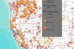
The climate models contain many parameters and the period ranges from a minimum of 5 years to 50 years. NASA fire firm website indicates that there more wildfires across the globe if we didn’t take adequate steps to meet the minimum standards of sustainability. Geospatial models in climate, forestry, and hydrological segments are highly useful to maintain the ecological balance for every geography and meet the demands of future generations. Environmental Impact Assessment (EIA) is mandatory in most geographies which are some good rules before the commencement of any construction.
Source: Open Access Government
Also Read –
Geospatial Technology to Mitigate Impact of Flooding


