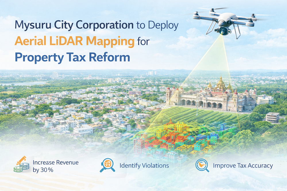
Mysuru City Corporation to Deploy Aerial LiDAR Mapping for Property Tax Reform
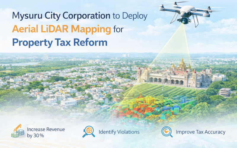
The Mysuru City Corporation (MCC) in Karnataka, India, has announced plans to implement Aerial LiDAR mapping technology from April 2026 to create a comprehensive, three-dimensional property map of the entire city. The LiDAR-based GIS mapping initiative aims to improve property tax assessment accuracy, identify building regulation violations, and ultimately increase annual municipal revenue by an estimated 30 percent.
Background: Urban LiDAR Mapping and Municipal Revenue Challenges
Mysuru, the second-largest city in Karnataka and a major heritage and tourism hub, has a property tax base of approximately 2.25 lakh registered properties. The MCC currently collects around Rs. 237 crore annually in property tax, but officials acknowledge significant revenue leakage from unreported floor additions, encroachments, and changes in land use. MCC Commissioner Shaikh Tanveer Asif has highlighted that comparable cities with smaller property bases — such as Varanasi — record significantly higher tax collection, suggesting widespread under-declaration in Mysuru. LiDAR
How Aerial LiDAR Mapping Will Work in Mysuru
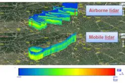
LiDAR Point Cloud Acquisition
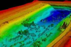
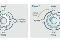
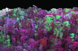
The MCC will deploy airborne LiDAR sensors mounted on fixed-wing aircraft or UAVs to emit laser pulses at the city’s built environment. The resulting point cloud data will capture property boundaries, building footprints, number of floors, rooftop structures, and land use features at sub-metre resolution. GNSS/INS integration on the aerial platform will provide precise georeferencing, enabling each data point to be assigned accurate spatial coordinates using post-processed kinematic (PPK) correction methods.
Also Read – GIS Resources Magazine (Issue 2 | June 2022): LiDAR For Real-World 3D Modelling Applications
GIS Analysis and Building Classification
Raw point cloud data will be processed to generate digital surface models (DSMs) and digital terrain models (DTMs), from which building heights, floor counts, and footprint areas can be automatically extracted. The GIS-based property database produced will be cross-referenced with existing municipal records to flag discrepancies — including excess floors built without authorisation and violations of Floor Area Ratio (FAR) limits — that have previously gone undetected.
Implementation and Study Area
The survey will cover the full jurisdiction of the MCC, which extends across nine administrative zones. Tenders for the aerial LiDAR acquisition contract are expected to be floated by April 2026. Water tax mapping will also be updated using LiDAR data, with water tax revenue projected to rise from Rs. 60 crore to nearly Rs. 90 crore annually. The technology will additionally support real-time monitoring of lake encroachments and illegal constructions near water bodies — a persistent challenge in Mysuru’s peri-urban areas.
Applications and Broader Impact
The Mysuru initiative demonstrates the expanding role of LiDAR mapping in smart city governance across India. Beyond property tax, the three-dimensional spatial data will inform urban planning, infrastructure management, and disaster risk assessment. Cities that have implemented comparable LiDAR-based systems have reported improved equity in tax assessment, reduced evasion, and enhanced public trust in municipal administration. Mysuru’s approach also aligns with the national Smart Cities Mission goal of data-driven urban governance.
Conclusion
By replacing manual site inspections with objective aerial LiDAR surveys, Mysuru City Corporation stands to recover substantial lost revenue while creating a spatially accurate urban baseline for future planning. The success of this initiative could serve as a template for other Tier-2 Indian cities looking to modernise municipal records using geospatial technology.
References
1. Star of Mysore (2026, March 10). MCC to adopt LiDAR tech to plug Property Tax losses. https://starofmysore.com
2. Times of India (2026, March 10). Mysuru city corporation to adopt LiDAR tech to increase tax collection. https://timesofindia.indiatimes.com
3. Star of Mysore (2025). MCC to use LiDAR tech to map properties. https://starofmysore.com