Recently Esri has introduced the latest version of ArcGIS Earth v1.8. ArcGIS Earth 1.8 delivers interactive analysis tools such as elevation profile, 3D measure, line of sight, and viewshed—with much more to come.
Tell your story by using the new bookmark function, which allows users to easily save areas of interest and navigate through a specific geographic location. You can also play a tour of bookmarks by sequence to communicate insights from any area of your choosing.
ArcGIS Earth 1.8 comes fully equipped with the new identify and edit drawing element features, which had been requested by users. Along with the update, ArcGIS Earth now supports the addition of web scenes and web maps from portals.
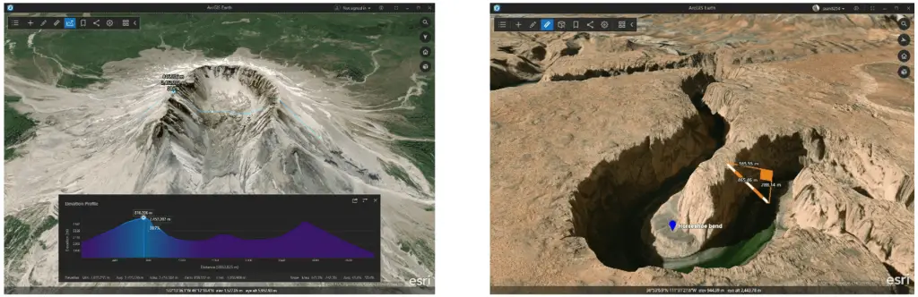
Elevation Profile and 3D Measure tool in 1.8 release.
Credit: Esri
Take your geospatial data and tell your story any way you see fit. The possibilities are endless in ArcGIS Earth 1.8.
ArcGIS Earth1.8 introduces the following 3D analysis capabilities:
- Elevation profile—Create a profile graph to visualize elevation change over a continuous distance.
- Line of sight—Perform interactive line of sight analysis from point or camera, and play animations.
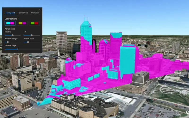
- Viewshed—Perform interactive viewshed analysis from point or camera, and play animations.
- 3D measure—Measure horizontal, direct, and vertical distance between two points in 3D.
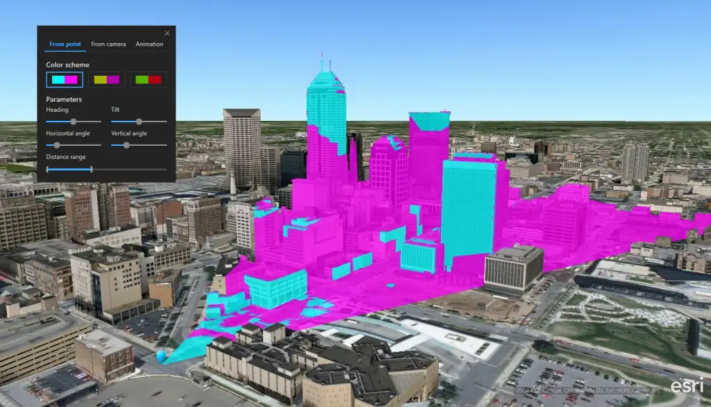
Viewshed Analysis
Credit: Esri
ArcGIS Earth 1.8 includes the following new feature capabilities:
- Support to perform interactive analysis including elevation profile, line of sight analysis and viewshed analysis
- Support to merge web scene and web map layers to ArcGIS Earth
- Support to measure distances in 3D
- Published ArcGIS Earth to the Microsoft Store
- Added bookmarks so you can save a specific location and refer to it later
- Added explore mode to explore an area of interest with predefined flight paths
- Support to add layer by entering its portal item URL
- Support feature collection
Source: ArcGIS Earth