Federal Aviation Administration (FAA) Administrator Michael Huerta today announced the public release of the B4UFLY mobile application following an initial beta testing period.
B4UFLY is an easy-to-use smartphone app that helps unmanned aircraft operators determine whether there are any restrictions or requirements in effect at the location where they want to fly.
B4UFLY tells users about current or upcoming requirements and restrictions in areas of the National Airspace System (NAS) where they may want to operate their unmanned aircraft system (UAS).
The app is now available for Apple devices and can be downloaded from the App Store.
The FAA also is releasing a beta version of B4UFLY for Android devices, which can be downloaded from Google.
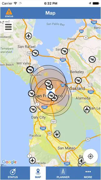
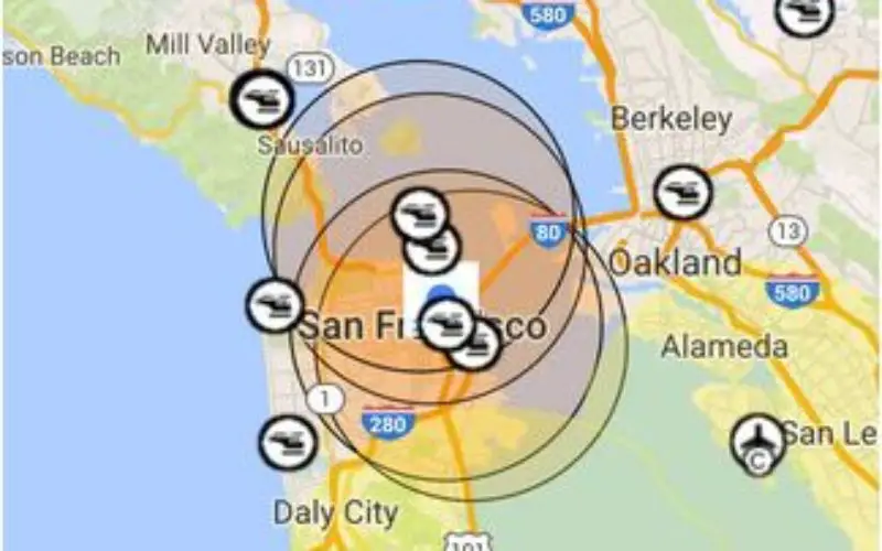
Key features of the B4UFLY app include:
- A clear “status” indicator that immediately informs the operator about the current or planned location. For example, it shows flying in the Special Flight Rules Area around Washington, D.C. is prohibited.
- Information on the parameters that drive the status indicator
- A “Planner Mode” for future flights in different locations
- Informative, interactive maps with filtering options
- Links to other FAA UAS resources and regulatory information
By law, hobbyists who want to fly within five miles of an airport must notify the airport operator and the air traffic control facility (if there is one) prior to flying. For now, B4UFLY will ask users who are supposed to notify the airport before flying for voluntary information about their planned flight. This will not meet the statutory requirement to notify the airport and air traffic control facility, but the data will help the agency make informed policy decisions related to notification. This information will not be publicly available.You can find more information on our
You can find more information on our B4UFLY webpage.