
Archive

PR: Leica Nova MS50 MultiStation Delivers First 3D Scan of the Mont Blanc Ice Cap
Reaching the top of Mont Blanc, Europe’s highest peak, is a formidable challenge even to the most experienced alpinists – not only because of its elevation, but also because of
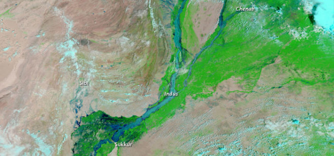
Pakistan to Adopt Remote Sensing and GIS Based Flood Mitigation System
In recent news by The Express Tribune, Pakistan Space and Upper Atmosphere Research Commission (SUPARCO) in collaboration with UNESCO will install satellite remote sensing and GIS technologies across Pakistan for
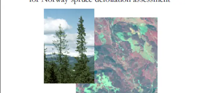
Evaluation of IRS-1C LISS-3 satellite data for Norway spruce defoliation assessment
Evaluation of IRS-1C LISS-3 satellite data for Norway spruce defoliation assessment Download Evaluation of IRS-1C LISS-3 satellite data for Norway spruce defoliation assessment “This blog does not host any contents or

Publishing a Map Service with ArcGIS 10.1
This video is useful for anyone with interest in this topic.
Analysis of Digital Elevation Model in ArcMAP
This is a how-to to demonstrate the creation of first and second order derivatives in ArcMAP using SRTM 3 data.
PR: Esri Announces Climate Resilience App Challenge 2014
Esri, the world leader in mapping technology, unveiled The Esri Climate Resilience App Challenge 2014, calling all developers to create an app using the Esri ArcGIS Platform to help communities, see,
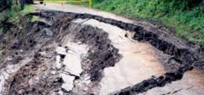
Microwave Radar Monitors Sliding Slopes
Geodesists from TU Darmstadt, Germany, research in the Alps The “Steinlehnen” slope in Northern Tyrol (Austria) started to move in 2003. Rockfalls threatened people, streets and buildings. Meanwhile, peace has

South Delhi Municipal Corporation to Use Geo-spatial Technologies for Waste Management
In recent news, South Delhi Municipal Corporation (SDMC) is planning to use geo-spatial technology for monitoring and implementation of waste management in municipal corporation area. The sanitation action plan includes GPS-tracked garbage

Crowdsourcing the Search for Malaysia Flight 370 – Join The Search
As the mystery of what happened to the 239 people on board Malaysia flight 370 deepens, a Colorado satellite imaging company is launching an effort to crowdsource the search, asking
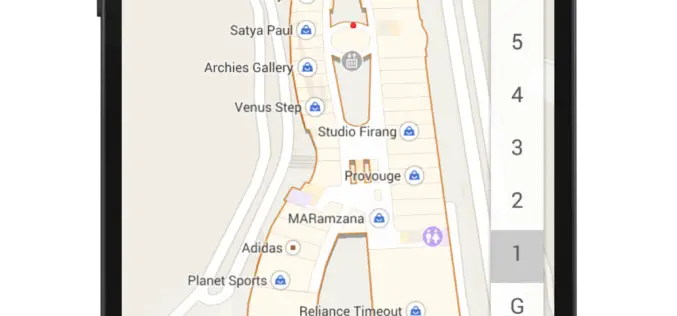
Indoor Google Maps for 75 Popular Indoor Venues
In a recent post in Google India blog, Indoor Google Maps comes up with 75 popular indoor venues across 22 cities in India. Google India has adopted My Location technology to
