
Archive

The 5Most Viewed Airborne Laser Scanners on Geo-matching.com
The Geo-matching.com website features a selection of the most important geomatics equipment, including Airborne Laser Scanners. At www.geo-matching.com you can compare product specifications and read users’ reviews before you buy.

GIM International Announces New Event: GIM International Summit
GIM International, the global print and media platform for geomatics, is excited to announce the inaugural GIM International Summit which it will be organising from 10-12 February 2016 in Amsterdam,

Google Maps Temporarily Shut Down Google Map Maker
Google has temporarily shut down the Google Map Maker service. Google Map Maker allows community to make edits to Google Maps. The reason the service was shut down because of
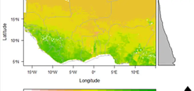
Space Technology Identifies Vulnerable Regions in West Africa
University of Leicester researchers in collaboration with NASA use satellites to map land degradation in Sub-Saharan West Africa A group of international researchers led by the Centre for Landscape and
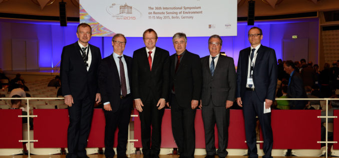
Satellites – A Reliable Source for Earth Observation
ISRSE – 750 experts meet in Berlin to discuss trends and challenges in remote sensing How is the ozone layer changing? What is the distribution of trace gases in Earth’s

FOSS4G Europe 2015 Announces Two New Keynotes Speakers!
The second edition of the FOSS4G Europe Conference will be held at Politecnico di Milano in Como, Italy, from July 15th to 17th, 2015. A day of workshops will precede
Take a Walk on the Wild Side: Environmental Surveying and TerraGo Edge
Take a Walk on the Wild Side: Environmental Surveying and TerraGo Edge May 19, 2015 12:00 – 12:30 PM ET Environmental field surveys provide valuable insights into our world’s most
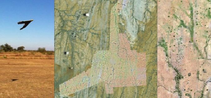
A Case Study: Using Drones in Place of LiDAR
Energizer Resources Inc., has started a major flagship project, a large graphite mining project at coast of East Africa, in Madagascar. it is named the Molo Graphite Project, or simply
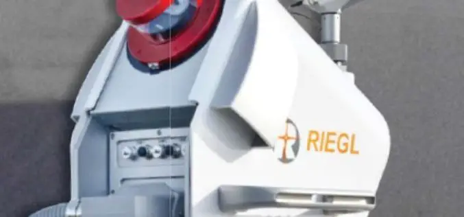
RIEGL LIDAR 2015 User Conference: RIEGL Presented Some Innovative Products
RIEGL launched the first part of its ambitious LIDAR 2015 “One Conference, Two Exciting Locations” in Hong Kong on May 05, 2015. The official welcome note was delivered by Mr.

Webinar: New Features in Geomatica 2015
New Features in Geomatica 2015 Thursday, May 14 at 8am GMT and 2pm EDT Geomatica is a powerful geospatial image processing software suite used by professionals, researchers and students around
