
Archive
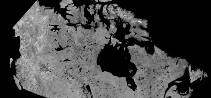
Download Free RADARSAT Data of Canada
Canada’s RADARSAT-1 is a radar satellite and was launched in November 1995. It carries a Synthetic Aperture Radar (SAR), it acquired images of the Earth day or night, in all

Delhi Gets GPS Enabled Water Tankers
As reported by IBN Live, Delhi government on Monday introduced the use of Global Positioning System (GPS) on its water tankers in its bid to improve service and check tanker
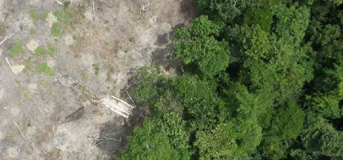
Radar Satellite Data for Mapping Dynamics of Deforestation and Forest Degradation
Have you ever think about the importance of forests in our daily lives of concrete jungles? Forests products are used in our daily lives. All activities directly or indirectly involve
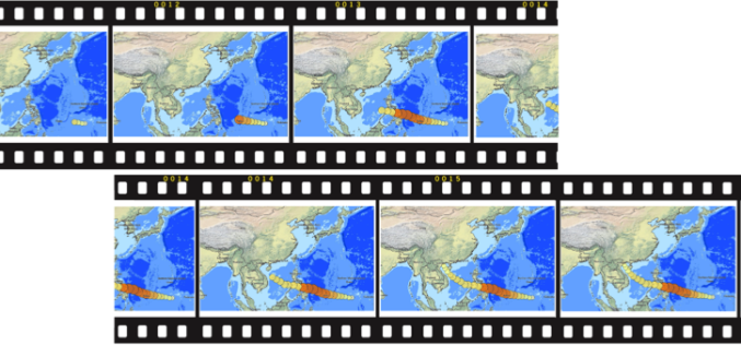
Egypt is Considering Purchasing of Russian Satellite Imagery
In recent news by Sputnik, Egypt is considering purchasing Russian satellite images for earth observation studies. This move comes after the loss of control by Egypt on its remote sensing

3D Mapping of Heritage Monuments for Tourism Promotion
According to recent news from ToI, the tourism department of Telangana state is going for 3D mapping of heritage monuments and buildings of city. Hyderabad city has many heritage monuments

Leica Introduce Leica Pegasus: Backpack Industry First Wearable Reality Capture
Leica Geosystems announced the commercial availability of Leica Pegasus: Backpack this week at HxGN LIVE. Leica Pegasus: Backpack is first of its kind in geospatial industry. It comes with a
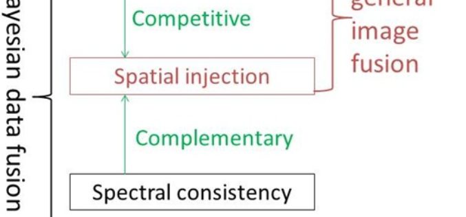
A New Look at Image Fusion Methods from a Bayesian Perspective
A New Look at Image Fusion Methods from a Bayesian Perspective – Hankui K. Zhang and Bo Huang Abstract: Component substitution (CS) and multi-resolution analysis (MRA) are the two basic categories in the
Time to Next SuperGIS Series
Have you ever tried to transform your traditional static map into a living, dynamic map with time dimension? This October, Supergeo is going to formally launch SuperGIS Desktop 10. There

New Leica Zeno 20 redefines GIS data collection
Leica Geosystems has unveiled its new GIS data collection solution, the Leica Zeno 20 – an extremely accurate and intuitive solution. The Leica Zeno 20 is the first high accuracy

USGS Ups Ease of Use for Landsat Data
Landsat satellite data have been produced, archived, and distributed by the U.S. Geological Survey since 1972. Data users in many different fields depend on this basic Earth observation information to
