
Archive

RIEGL and Aeroscout Announce Strategic Partnership!
RIEGL Laser Measurement Systems (Austria) and Aeroscout (Switzerland) are excited to announce a strategic partnership between companies RIEGL and Aeroscout have worked closely for many years. As a pioneer in
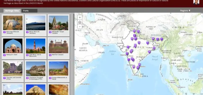
Story maps by Esri Inc
Contributed By – Everyone has a story to tell.Harness the power of maps to tell yours. Esri Story Maps let you combine authoritative maps with narrative text, images, and multimedia
Madhya Pradesh to Launch GIS Based Services for Identification of Land by Investors
Bhopal, India: Madhya Pradesh Government will launch geographical information system (GIS) for the land earmarked for the industries in the state. This will facilitate online identification of land by investors
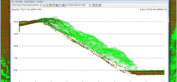
Global Mapper v17.1 LiDAR Module Now Available
Global Mapper v17.1 LiDAR Module Now Available With the New Custom Feature Extraction Tool Blue Marble Geographics is pleased to announce the immediate availability of an upgrade to the Global
Esri Announces Big Changes to Small Government Enterprise License Agreement Program
Now Governments with Populations Up to 250,000 Are Eligible Esri has announced a significant change to its Small Municipal and County Government Enterprise License Agreement (ELA) program. Municipal and county

Safer Seafaring with Satellites – DLR Produces Radar Images at Its Antarctic Station in Near Real Time
Sailing in the regions that polar researcher Arved Fuchs is currently navigating in his ship ‘Dagmar Aaen’ is a not an easy task. The ‘Ocean Change’ expedition is travelling around

Growing Adoption of Open-Source GIS Software Driving the Global GIS Market Through 2020, Says Technavio
LONDON–(BUSINESS WIRE)–According to the latest market study released by Technavio, the global geographic information system (GIS) market is set to reach close to USD 16 billion by 2020, growing at

Learn What Sentinel-3 Will Tell Us About Oceans
Most of our planet is covered by oceans, which are directly linked to our weather and climate, and so play a key role in our well-being and economy. Still our
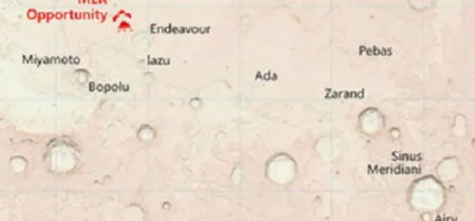
Ordnance Survey Has Created Map of the Martian Landscape
607 paper maps, the most detailed digital data picture of Great Britain, and now one red planet Using NASA open data, Ordnance Survey has created a one-off paper and digital map of

Bluesky Sponsors UNESCO Biosphere Reserve Expansion in Kenya
Leicestershire, 16 February 2016 – Aerial mapping company Bluesky is aiding the expansion of a UNESCO Biosphere Reserve in Kenya. Working with Cranfield University, the UK-based aerial survey specialist will provide
