
Archive
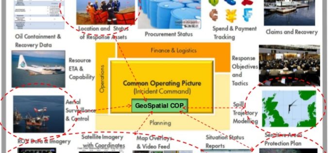
OGC announces Oil Spill Response Common Operating Picture Recommended Practice
02 March 2016: The Open Geospatial Consortium (OGC®) announces that the International Association of Oil & Gas Producers (IOGP) through the Geomatics Committee and IPIECA (the global oil and gas

PCI Geomatics Releases GXL 2016
MARKHAM, Ontario, Canada – March 1, 2016: PCI Geomatics, a world leading developer of remote sensing and photogrammetric software and systems, announced today the release of its GeoImaging Accelerator (GXL)

World Campus Remote Sensing Certificate Helps GIS Professionals Use Drone Data
UNIVERSITY PARK, Pa. — Drones are suddenly everywhere — gathering crop data, monitoring air pollution, helping with search-and-rescue missions and even taking “drone selfies.” But the increase of data collection

Trimble Adds GNSS Positioning to its Field Link Layout Solution for General Construction Contractors
SUNNYVALE, Calif., March 1, 2016—Trimble (NASDAQ: TRMB) announced today that its construction layout software, Trimble® Field Link, can now be used with the Trimble R8s GNSS receiver. This addition extends

myWorld 3, A Significant Leap Forward for Geospatial Mobility Platforms
Ubisense Group plc, a leader in enterprise location intelligence solutions, has released myWorld 3, a significant leap forward for the state of the art in modern geospatial mobile platforms. Key
Supergeo Supports Vector Tiles
Vector tiles are a good way to manipulate your vector data through the internet. It helps users to display and use a large quantity of detailed vector data while maintaining
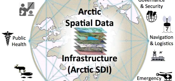
OGC Requests Information to Guide Arctic Spatial Data Pilot
The Open Geospatial Consortium (OGC®) requests information to help advance the “Arctic Spatial Data Pilot”. The Arctic Spatial Data Pilot is an OGC Interoperability Program initiative sponsored by the U.S.

10th International GIS-Forum “Integrated Geospatial Solutions – the Future of Information Technologies”
In 2016 it will be 10th edition of International GIS-Forum “Integrated Geospatial Solutions – the Future of Information Technologies”. We are happy to cordially invite you to participate and celebrate this
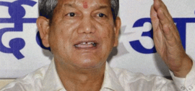
GIS, GPS Would Have Helped Tackle 2013 Uttrakhand Calamity Better
Dehradun: Underlining the importance of using Geographic Information System and Global Positioning System in the state’s remote hill areas, Chief Minister Harish Rawat has said maximum use of these technologies
