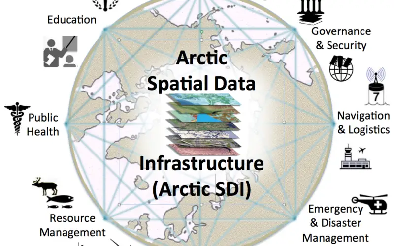
The Open Geospatial Consortium (OGC®) requests information to help advance the “Arctic Spatial Data Pilot”. The Arctic Spatial Data Pilot is an OGC Interoperability Program initiative sponsored by the U.S. Geological Survey and Natural Resources Canada. This recently launched initiative aims to help all Arctic stakeholders benefit from improved access to the expanding universe of online Arctic geographic information. The emerging Arctic SDI, an evolving technical and organizational network of diverse information resources and collaborating players, will play a key role in pan-Arctic science and monitoring as well as societal, economic, regulatory, and environmental decision support.
“It’s important that scientists, resource managers, decision-makers and our citizens can discover, access and use trusted data to conduct research, make informed decisions, and respond to emergencies in the Arctic,” said Kevin Gallagher, Associate Director for Core Science Systems, U.S. Geological Survey. “This pilot is meant to advance the understanding of best practices for the distribution of geospatial data.”
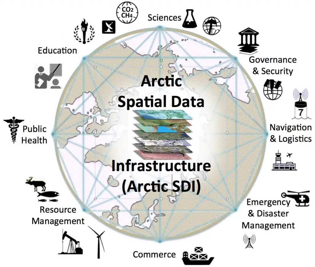
This OGC Arctic Spatial Data Pilot Request for Information (RFI) will help the U.S. Geological Survey and Natural Resources Canada collect information to demonstrate the diversity, richness and value of Spatial Data Infrastructure (SDI) Web services that can be made available to Arctic SDI stakeholders. Information gathered and publicly reported by the initiative will expose opportunities for stakeholders to make better use of Web technologies for publishing, discovering, assessing, accessing, integrating, aggregating and analyzing geospatial data and related non-geospatial data.
The purpose of this RFI is to gain a better understanding of the full potential of an Arctic SDI to serve the Arctic community. What is it exactly? What data and Web services are available and what needed data and Web services are missing? What are the data sharing and data integration requirements of the different Arctic communities? What does the ideal architecture of an Arctic SDI look like? What key stakeholders need to contribute to a more concerted development process? What scenarios and use cases should be considered as part of this OGC Pilot? Readers of this RFI are encouraged to respond with recommendations for procedures, technology, data, or open standards that should be considered to be included in a recommended practice for Arctic SDI.
RFI responses will be discussed with an expanded set of sponsoring organizations that will review information interoperability and integration requirements and then outline funding opportunities for Arctic SDI standards technology developments planned for later this year. With consideration of active developments in OGC’s current Testbed 12 initiative and in its current work with ISO, the World Wide Web Consortium (W3C) and other standards groups, OGC will document the needed interoperability and integration requirements in a Request for Quotations (RFQ). The RFQ will invite technology providers to describe work they offer to do to address those Arctic SDI interoperability requirements. RFI respondents will be considered in future Open Geospatial Consortium, Natural Resources Canada, United States Geological Survey, Academic funding bodies, or other opportunities. All RFI responses will contribute to Arctic SDI considerations moving forward.
Responses to the RFI are requested by March 18, 2016. The RFI includes instructions on how organizations can respond to and submit questions about the RFI.
The OGC is an international consortium of more than 515 companies, government agencies, research organizations, and universities participating in a consensus process to develop publicly available geospatial standards. OGC Standards empower technology developers to make geospatial information and services accessible and useful with any application that needs to be geospatially enabled. Visit the OGC website athttp://www.opengeospatial.org.