
Archive
UK Geospatial Commission is Working to Establish Scottish Geospatial Network Integrator
The recent news published on the UK Government website says that the UK Geospatial Commission is working with Scottish Enterprise and the Scottish Government to establish a Geospatial Network Integrator
Geospatial Sewerage Surveillance System to Detect Early Warning for Covid
Transerve has introduced a ‘Geospatial Sewerage Surveillance’ model which offers community-based group testing with routine monitoring of sewage as a non-invasive early warning tool.
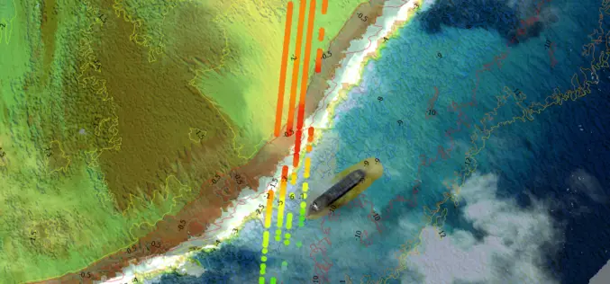
TCarta Develops AI-Based Commercial Bathymetric Mapping Technologies with National Science Foundation Grant
First Commercial Use of ICESat-2 TCarta Marine, a global provider of hydrospatial products, has announced development of new Machine Learning-based bathymetric mapping technologies – including creation of two software packages
UP42 Partners with Intermap to Bring High-Resolution Elevation Data to UP42’s Geospatial Marketplace
UP42 is pleased to announce that the NEXTMap Elevation Data Suite from Intermap Technologies is now offered on the UP42 developer platform for Earth observation data and analytics. The NEXTMap
Aspectum and Planet Enter into a Partnership to Offer Powerful Analytics Paired With Robust Satellite Imagery
New partnership that allows Aspectum users to access Planets high-resolution satellite imagery and rich geospatial data Aspectum and Planet have announced the formation of a strategic partnership to offer businesses

GSA Releases the 3rd GNSS User Technology Report
With four Global Navigation Satellite Systems (GNSS) available and more than 100 satellites in operation broadcasting multiple frequencies, the GNSS industry is witnessing a shift towards the wide adoption of
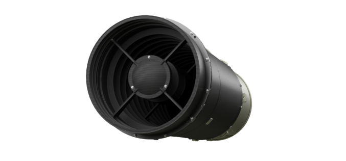
EOS Data Analytics to Launch a Satellite with Dragonfly Multispectral Imagers in 2022
EOS Data Analytics has announced the conclusion of an agreement with Dragonfly Aerospace for the delivery of two HR-250 high-performance multispectral imagers. A satellite equipped with the Dragonfly imagers will

Upcoming Self-Driving Volvo Cars to be Supported by LiDAR for Safety
In collaboration with technology firm Luminar, leading automobile manufacturer Volvo is releasing a new car in a couple of years with cutting-edge perception technology that could finally see self-driving cars on public roads.
Startup EarthDefine Uses AI for Building Footprint Geocoding
EarthDefine, a provider of high-resolution geospatial spatial data that uses artificial intelligence (AI) to analyze aerial and LIDAR imagery, today announced the release of an updated building footprint database, which

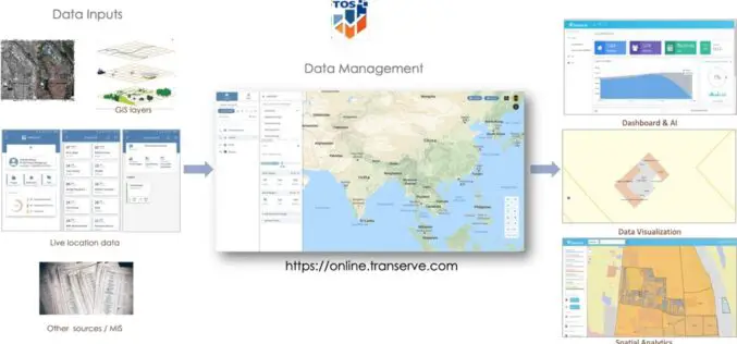
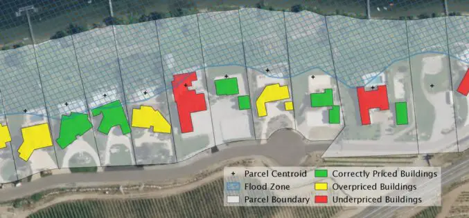
Big Data for Effective Decision Making – A Talk with Ashwani Rawat, Co-Founder & Director of Transerve Technologies
Transerve Technologies Pvt Ltd is a technology leader in the field of location-intelligence for effective decision making. Having been acknowledged as a top emerging and innovative company by NASSCOM and Deloitte,
