
Archive
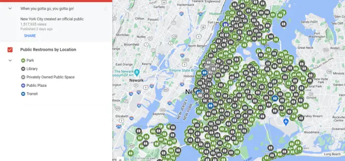
Google Maps Now Shows Public Toilets in New York City
New York City (NYC) has implemented a new layer on Google Maps to display public restroom locations, addressing the ongoing challenge of finding accessible restrooms across the city. The official
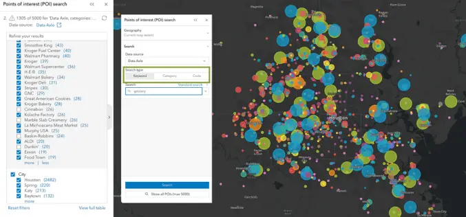
Unveiling the Latest Enhancements in ArcGIS Business Analyst Enterprise: May 2024 Update
Esri has announced an exciting array of updates in the May 2024 release of ArcGIS Business Analyst Enterprise, enhancing its capabilities for businesses seeking to leverage geographic data for better

Understanding China’s BeiDou-Only Mandate: Strategic and Global Implications
According to recent news by MSN, China is launching a new campaign to crack down on the theft of sensitive geographical data by foreign powers with its BeiDou-only mandate, the

SparkFun Electronics Launch RTK Torch with Millimeter-Level Accuracy
SparkFun Electronics recently launched the RTK Torch, a high-precision GNSS product designed for various geolocation and GIS applications. This new device offers millimeter-level accuracy and is built to withstand tough

Training Announcement – Drought Monitoring, Prediction, and Projection using NASA Earth System Data
The United Nations has documented that drought frequency and duration have increased globally since 2000. According to this report 2.3 billion people around the world are currently facing water stress.
TRISHNA Mission Set to Revolutionize High-Resolution Thermal Imaging
The TRISHNA Mission, a collaborative endeavour between the Indian Space Research Organisation (ISRO) and the French space agency CNES, is set to revolutionize the monitoring of Earth’s surface temperature. TRISHNA

Northeast Frontier Railway (NFR) to Conduct Airborne LiDAR Survey
The Indian Railway’s Northeast Frontier Railway (NFR) zone is set to conduct an Airborne LiDAR Survey on the Lumding to Badarpur hill section. This advanced survey will take place during
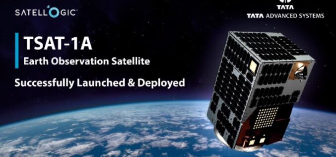
TSAT-1A India’s First Privately-Built Satellite with Sub-Metre Resolution
Developed by Tata Advanced Systems Limited (TASL) in collaboration with Satellogic, TSAT-1A is a state-of-the-art geospatial satellite launched on SpaceX’s Falcon 9 rocket in April 2024. The satellite is designed
