
Archive

USGS Advances Colorado Geological Mapping with Low-Flying Helicopters
The U.S. Geological Survey (USGS) has launched an extensive project to map Colorado’s geological history using low-flying helicopters equipped with sophisticated geophysical instruments. Starting in mid-August 2024, these flights will

LiDAR Survey for Landslide Risk Management in Uttarakhand
In a recent executive committee meeting of the Uttarakhand Landslide Reduction and Management Centre (ULMMC), Chief Secretary Radha Raturi underscored the urgency of bolstering landslide management and mitigation efforts in
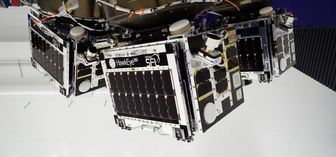
Space Flight Laboratory (SFL) Confirms Successful Deployment of HawkEye 360 Microsatellite Cluster 10
Space Flight Laboratory (SFL) confirmed that HawkEye 360 Cluster 10 has been successfully launched and deployed in orbit. Cluster 10 brings to 30 the total number of radio frequency geolocation

From Desert to Orbit: UAE Unveils First SAR Satellite
The UAE successfully launched its first Synthetic Aperture Radar (SAR) satellite on August 16, 2024, as part of its Earth Observation Space Program. This satellite, developed through a collaboration between
Krishi-DSS: Pioneering a New Era in Indian Agriculture
The Indian government has recently launched the Krishi-Decision Support System (Krishi-DSS), a pioneering geospatial platform designed to revolutionize agriculture in India by offering farmers real-time data and insights. Developed through

Lesser-Known Aspects of Building a Safe Office
Trying to design the perfect office means that you have to cover a lot of different perspectives. You might be most enthusiastic to address issues that pertain directly to your

What Makes EOS-08 Mission a Game-Changer in EO
In a significant stride for India’s space capabilities, the Indian Space Research Organisation (ISRO) successfully launched the Earth Observation Satellite EOS-08 on August 16, 2024. The mission, executed via the

How Spatial-Temporal Data Revealed Hepatitis B Patterns in China
Hepatitis B virus (HBV) infection remains a significant public health concern in China, a country with one of the highest burdens of this disease worldwide. Despite ongoing efforts to control

A Look Into The Growing Prevalence of Semi-Truck Accidents
Accidents involving large vehicles undeniably have devastating effects on both life and property. Due to the sheer size and weight of these vehicles, their collision leads to catastrophic outcomes. In

India to Assist Nepal in Launching First High School CubeSat ‘Munal’ Satellite
The Ministry of External Affairs (MEA) of India and NewSpace India Limited (NSIL) have signed a Memorandum of Understanding (MoU) to assist in launching Nepal’s Munal satellite. This collaboration is
