
Posts From GIS Resources
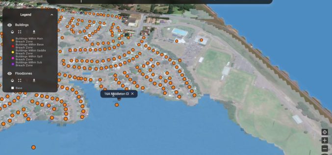
Rezatec Launches Advanced Geospatial AI for Dam Monitoring
Rezatec has launched a groundbreaking solution for dam operators with its enhanced geospatial AI platform for dam monitoring. This cutting-edge platform is set to transform how dam safety and risk
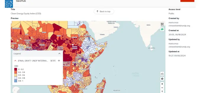
Advancing AI-Driven Energy Equity with Geospatial Technology
The United Nations Development Programme (UNDP) and IBM have launched two advanced models that combine AI and geospatial technology to promote clean energy access and equity. These tools, hosted on
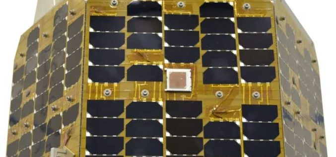
What is Iran’s Chamran-1 Research Satellite?
Iran took a significant step forward in its space ambitions with the launch of its latest research satellite, Chamran-1, into orbit. The satellite was successfully placed into a 550-kilometer orbit
Golden Software Enhances Surfer® Mapping and 3D Visualization Package with Map Templates and Online Image Access
Golden Software has added significant time-saving features to the latest version of its Surfer mapping and 3D visualization software. Users can now choose from more than 20 frame templates to
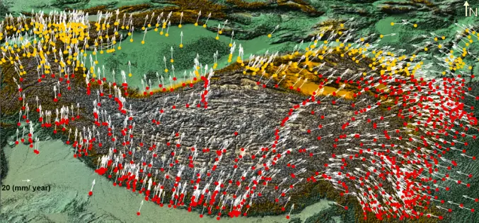
Enhancing Tectonic Studies with Machine Learning For Crustal Velocity Prediction
Crustal deformation is a critical area of study, especially in tectonically active regions like the Tibetan Plateau. In their research, Bappa Mukherjee, et. al. present a novel approach using machine
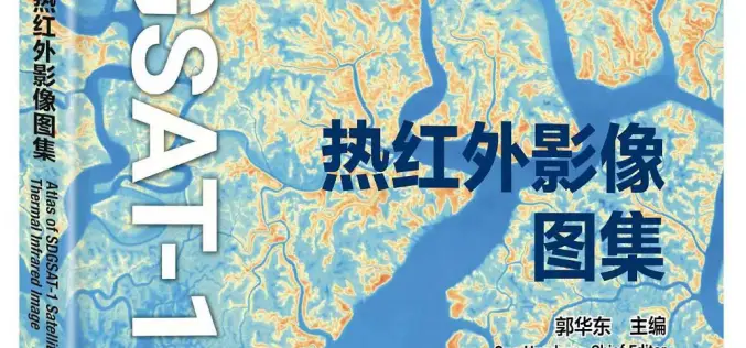
China Unveiled World’s First Thermal Infrared Atlas
China has made a groundbreaking contribution to global sustainability efforts by releasing the world’s first Thermal Infrared Atlas. The atlas was launched during the 4th International Forum on Big Data
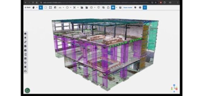
New Reality Capture Platform Service Leverages Trimble Connect to Maximize the Value of Geospatial Data for Millions of Users
Trimble has announced its new Trimble® Reality Capture platform service to enable more effective collaboration and the secure sharing of massive reality capture datasets captured with 3D laser scanning, mobile mapping

Merkator and RMSI Partner to Accelerate Telecom Network Geospatial Transformation
Merkator, a leading provider of next-generation network inventory solutions for telecom operators, today announced a strategic partnership with RMSI UK, a global leader in geospatial solutions and services. This collaboration, via the MarlinDT
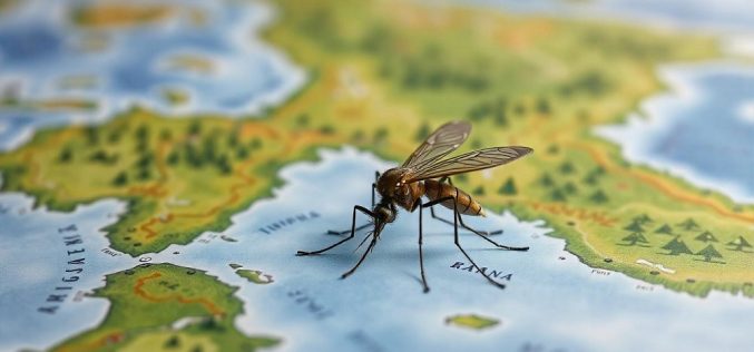
AI Mosquito Mapping in Fighting Mosquito-Borne Diseases
A team of researchers at Heidelberg University has introduced a pioneering AI mosquito mapping technique to track Aedes aegypti populations, the species responsible for spreading diseases like dengue, Zika, chikungunya,
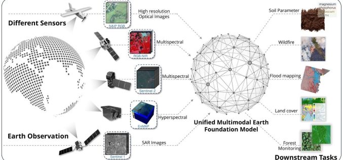
TorchGeo 0.6.0: Advancing Geospatial Machine Learning
TorchGeo 0.6 marks a significant step forward in geospatial machine learning by offering new datasets, data modules, and pre-trained models for satellite image analysis. Over 11 months, 23 contributors worked
