
Posts From GIS Resources
Get the Hang of latest SuperGIS Desktop 3.2
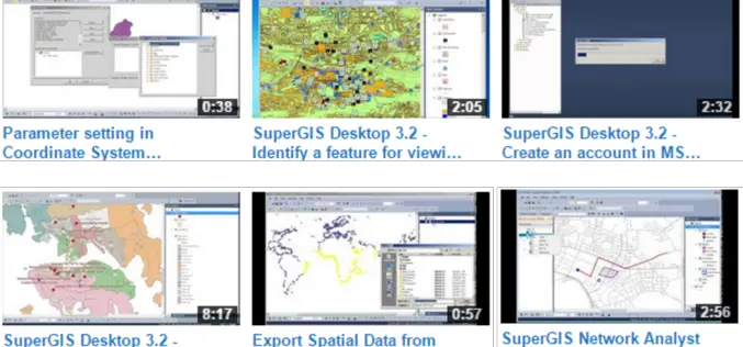
Supergeo Technologies Inc., the global leading GIS software and solution provider, released new Product Demo Videos on Supergeo TV Channel to demonstrate most frequently-used functions in latest SuperGIS
SuperGIS Assists Talented Youth in Winning Geography Olympiad Champion
Supergeo Technologies, the global leading GIS software and solution provider, announce that SuperGIS was chosen in Taiwan Geographic Olympiad 2014 and helped the participants win the first award. The winners

Island University Receives Approval for Ph.D. in Geospatial Computing from Texas Higher Education Coordinating Board
October 24, 2014-AUSTIN, Texas, The Texas Higher Education Coordinating Board approved Thursday (Oct. 23) the creation of a Ph.D. program in geospatial computing at Texas A&M University-Corpus Christi. The first

StreetMapper First for Australia
Surveying company Whelans has purchased Australia’s first StreetMapper mobile laser scanning system from 3D Laser Mapping. Whelans purchased the system, which uses vehicle mounted lasers to capture highly

Ordnance Survey Becomes a Corporate Supporter of the Open Data Institute (ODI) Membership Programme
Ordnance Survey is pleased to announce that it has signed up to corporate supporter membership of the Open Data Institute. It will join organisations such as the Met Office, Arup,

Ph.D. Opportunity with Visvesvaraya National Institute of Technology
Visvesvaraya National Institute of Technology, Nagpur is one of the thirty National Institutes of Technology in the country. The Govt. of India conferred on the Institute, the Deemed to

Visually Challenged Soon Have 3D Printed Maps
Recently in news, Japan’s cartographic authorities have announced that it has developed a software that allows users to download data from the internet and produce low cost geographical maps

1Spatial Australian Local Government GIS Survey Finds Councils Would Benefit from Smart Geospatial Technologies
Many councils performing geospatial tasks manually because of poor data quality and lack of integration with other data SYDNEY, Australia – 27 October 2014 – 1Spatial Group, global

Get Your Boarding Passes to NASA’s Orion – A Journey to Mars
NASA’s newest spacecraft, Orion, will be launching into space for the first time in December 2014, on a flight that will take it farther than any spacecraft built to carry
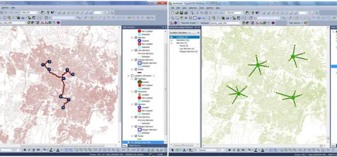
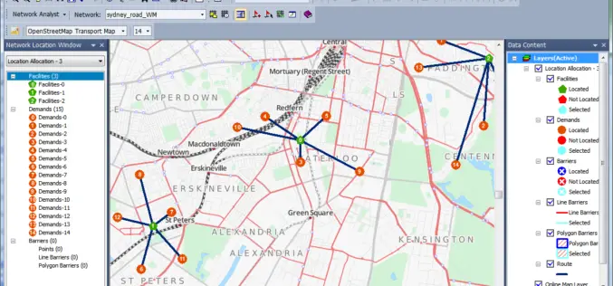
Supergeo Launches the Newest SuperGIS Network Analyst 3.2
Supergeo Technologies Inc., the global leading GIS software and solution provider, launches the newest SuperGIS Network Analyst 3.2 with stronger analysis performance and computing methods. SuperGIS Network Analyst 3.2 enables
