Benefits of Geospatial Data in Driving Analytics
Geospatial data has become an indispensable asset in today’s increasingly data-centric era, providing businesses, governments, and researchers alike with invaluable resources for making strategic decisions and driving transformation across multiple industries. By linking a wealth of information directly with specific locations on Earth’s surface, geospatial information has quickly become an indispensable resource.

Its effective utilization holds the potential to drive robust analytical insights, presenting plenty of advantages. In this blog post, we embark on a journey through the myriad ways in which geospatial data fuels the engine of analytics, revealing its profound impact and unparalleled benefits.
Enhanced Decision-Making
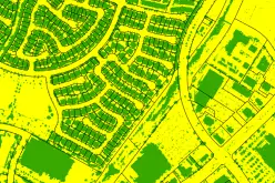
Geospatial data plays a pivotal role in empowering decision-makers by allowing them to create maps from zip codes, which provide a unique perspective on data visualization. These maps enable a deeper understanding and more insightful interpretation of information.
For instance, businesses can make a map from zip codes and pinpoint areas with high customer density, facilitating well-informed decisions regarding store placements, marketing strategies, and resource allocation. Similarly, government agencies can leverage geospatial data to make a map from zip codes, enhancing their ability to plan infrastructure development, streamline emergency response efforts, and guide sustainable urban growth.
Real-Time Insights
Real-time insights derived from geospatial data are a game-changer for businesses. By seamlessly integrating GPS and cutting-edge satellite technology, companies gain the ability to monitor and track their vehicles, shipments, and personnel movements in real time.
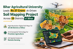
This not only enhances their understanding of operations but also greatly boosts efficiency. In the agricultural sector, for instance, farmers can utilize this technology to closely monitor crop health. The immediate data allows them to make precision decisions on irrigation and fertilization, leading to substantial reductions in resource wastage and remarkable improvements in crop yields.
Disaster Management and Response
Annually, natural disasters claim the lives of approximately 45,000 individuals worldwide. Geospatial data plays an integral part in disaster management and response. Organizations can utilize satellite imagery, GPS systems, and geographical information systems (GIS) during natural disasters like hurricanes, wildfires, or earthquakes to assess the situation quickly and coordinate rescue and relief efforts effectively, possibly saving lives through better resource allocation.
Environmental Conservation
Geospatial data is an indispensable asset to environmentalists and conservationists. Geospatial information allows researchers to more closely observe ecosystems while monitoring wildlife migration, deforestation, and changes to the environment over time. Geospatial data also plays a crucial role in understanding climate change impacts, as well as making informed conservation decisions to preserve endangered species and habitats.
Market Analysis and Targeted Marketing

Companies can leverage geospatial data to gain a competitive edge by conducting in-depth market analysis.
By studying the demographics, preferences, and behaviors of their target audiences in specific geographic areas, businesses can tailor marketing strategies more precisely. Geospatial data enables businesses to pinpoint profitable locations quickly while planning advertising campaigns effectively and accurately evaluating market potential with ease.
Urban Planning and Smart Cities
The success of smart cities hinges extensively on the strategic application of geospatial data and analytics. Urban planners leverage this invaluable resource to meticulously design cities that prioritize sustainability and efficiency. Through geospatial insights, they achieve optimized traffic management, reduced energy consumption, and improved public services. The collective impact of these measures ultimately translates into a notably elevated quality of life for residents.
Additionally, geospatial information contributes to the enhancement of public transportation systems, streamlining emergency response protocols, and refining waste management practices. These cumulative improvements contribute significantly to the overall well-being of urban inhabitants.
Natural Resource Management
Geospatial data is a valuable tool for managing and conserving natural resources. Forestry and agriculture industries use it to monitor and manage land and resources efficiently. For example, it helps in tracking tree growth, forest health, and illegal logging activities.
Geospatial data also plays a pivotal role in optimizing fishing activities, ensuring sustainable and responsible resource management.
Healthcare and Public Health
Geospatial data has made significant contributions to healthcare and public health. It is used to track disease outbreaks, identify areas at risk, and allocate medical resources effectively.
For instance, during a disease outbreak, such as the Zika virus or COVID-19, public health officials can use geospatial data to map the spread of the disease and target interventions in the most affected areas. This can be crucial in preventing further transmission.
Transportation and Logistics
Geospatial data has become an invaluable asset to transportation and logistics companies, allowing them to optimize routes, reduce fuel consumption, and boost overall supply chain efficiency. Amazon and FedEx, for example, use geospatial data extensively when planning routes for their drivers, using it to ensure timely deliveries while cutting operational costs as a result of timely deliveries.
In Closing
Geospatial data has become an essential asset to businesses, governments, and organizations across all sectors. Its capacity to provide spatial context and real-time updates has revolutionized how decisions and operations are undertaken. From enhancing urban planning to improving disaster response and environmental conservation, geospatial data has proven its value time and again.
As technology develops, geospatial data applications for driving analytics will only expand, creating even greater benefits to society at large. Harnessing geospatial data’s potential is no longer optional; rather, its use must become essential to success and progress.