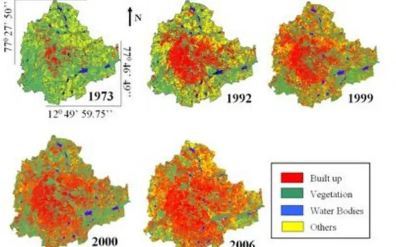
In a study by a group of scientists at Indian Institute of Science (IISc) has actually put a number changing land use and land cover in Bengaluru. Between 2000 and 2014, there was a 125% increase in built-up area in the city, which vegetation shrank 62% and water bodies 85%.
Dr Bharath H Aithal and his team at IISc studied the spatial development of Bengaluru in respect to urban growth over the last few years.
The study was carried out using remote sensing Landsat satellite data (from 1999 to 2014) to explore spatial patterns of land-use changes. According to study with the present trend of urban growth, in the coming years 57% of Bengaluru will be covered by built-up area by 2020 from the current 29%.

Temporal land use changes in Greater Bengaluru
Dr. Aithal said the study results show a tendency of dispersed growth in all directions.
“This phenomenon is most prominent in northwest and southwest directions. It is sad to know that vegetation cover has decreased from 45% to a mere 8.4% and water bodies diminished to a mere 0.74%,” he added.
The land-use classification was algorithmically computed and categorized as urban (buildings, roads and paved surfaces), vegetation (parks, botanical gardens and grasslands such as golf courses), water bodies (lakes, sewage treatment tanks) and others (playgrounds, quarry regions and barren land).
– Times of India