
GIS
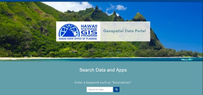
Hawaii Launches Geospatial Data Portal
According to recent news, the state Office of Planning’s Hawaii Statewide Geographic Information System (GIS) Program launched a new Geospatial Data Portal, which provides streamlined access to hundreds of data
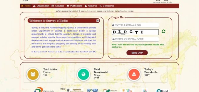
Survey of India Launches Web Portal to Download Maps
According to recent news reported by PTI, the government on Monday launched a website giving people the access to download 3,000 maps prepared by the Survey of India (SoI) but
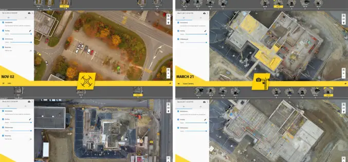
6 Major Construction Companies Adopt New Bim Monitoring Solution
Construction professionals understand that daily visualization of a job site helps minimize construction delays, prevent clashes between as-built and as design, eliminate the need for rework, facilitate stakeholder communication and
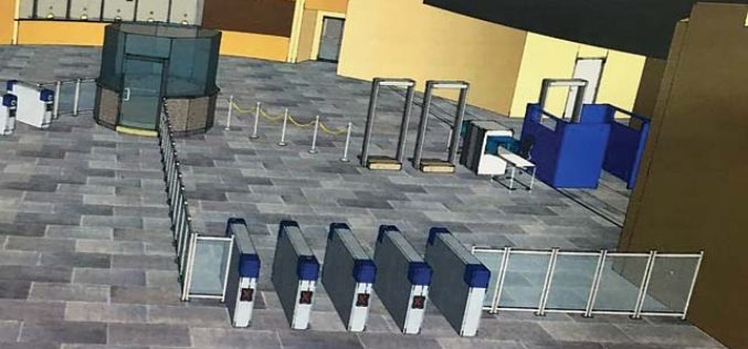
3D Mapping of Delhi Metro Station to Help CISF
New Delhi, India – According to recent news the DNA, all the major Delhi Metro stations have gone through the 3D mapping, this shall certainly help Central Industrial Security Force (CISF)

Pune Municipal Corporation Using Geo-tagging Data to Identify Illegal Properties
According to recent news by the Pune Mirror, the Pune Municipal Corporation (PMC) has decided to conduct a survey of unauthorised structures that come up before December 2015. The state has

mApp Your Way – Esri India App Development Challenge
mApp Your Way is an application (mobile or web) development challenge being organized by Esri India. The challenge intends to provide a platform to the institutes and students (UG/PG/Research scholars) to showcase

Sharjah Rolled Out Geo-address Across the Emirate
Finding your way around in Sharjah is get a whole lot easier. According to recent news reported by the Gulf News, the Sharjah Urban Planning Council (SUPC) has started a full
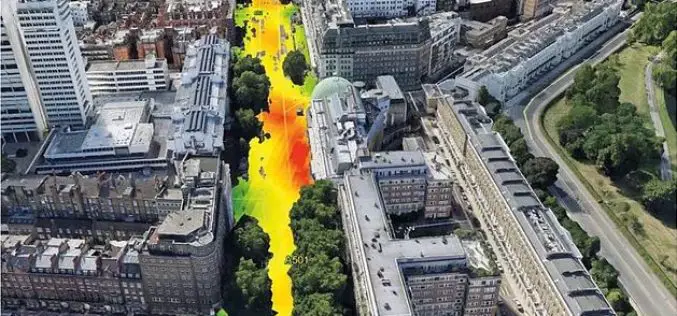
EarthSense Systems Computer Models Impact of Trees on Urban Air Pollution
Software developed by EarthSense Systems has been used to assess how trees impact on urban air quality on one of London’s most polluted streets. Called FluidAir, the state of the
Swiss Geospatial Data Now Available as Linked Data
The Swiss geoportal has started to publish geospatial data as linked data. This geoportal is harvested by the national Swiss Open Data portal, which is in turn harvested by the
Chinese Scientists Use Remote Sensing Technology to Digitize Great Wall
Researchers from the Chinese Academy of Sciences (CAS) recently used remote-sensing equipment in their efforts to restore a vanished section of the Great Wall in Northwest China’s Xinjiang Uyghur Autonomous
